|
search place name
|
||
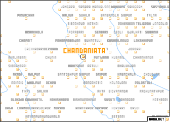
Chāndani Āta (Barisāl, Bangladesh)Chāndani Āta is a town in the Barisāl region of Bangladesh. An overview map of the region around Chāndani Āta is displayed below.
regional and 3d topo map of Chāndani Āta, Bangladesh ::
Chāndani Āta airports ::
The nearest airport is DAC - Dhaka Zia Intl, located 90.2 km south of Chāndani Āta.
Other airports nearby include IRD - Ishurdi (126.8 km south west), IXA - Agartala (135.5 km south east), RJH - Rajshahi Shah Mokhdum (160.2 km west), ZYL - Sylhet Osmani Osmany Intl (174.1 km east), Nearby towns ::
Khājulia (0.0km north) //
Dari Kātbaola (0.0km north) //
Mauhātala (0.0km north) //
Gosāsana (1.9km north) //
Beribāri (1.7km east) //
Bāokpālia (2.5km south west) //
Mahespur (2.5km south west) //
Pātuli (2.5km south east) //
Godhāpāra (2.5km north west) //
Kamalāpur (2.5km north west) //
Koka Dānga (2.5km north west) //
Kātbaola (2.5km north west) //
Gārājān (2.5km north east) //
Sibpur (3.7km south) //
Harirāmbāri (3.7km south) //
Kātgara (3.7km south) //
Dāogaon (3.7km north) //
Prānnāthbāri (3.7km north) //
Sadāsibbāri (3.7km north) //
Dhāmār (3.4km east) //
Putijāna (3.4km east) //
Bālughāt (4.1km south west) //
Chak Kānchichora (3.8km south east) //
Khilbāri (4.1km north west) //
Sukpātuli (4.1km north east) //
Mahespur (4.1km north east) //
Ghorsāil (4.1km north east) //
Bāde Pābaijān (4.1km north east) //
Rāmbāri (3.8km north east) //
[all distances 'as the bird flies' and approximate] 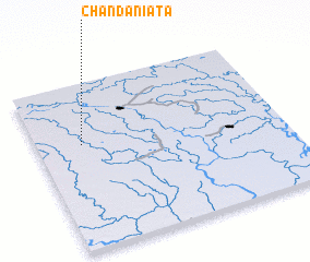 Places with similar names to Chāndani Āta, Bangladesh ::
// Chindant (RU)
// Chandandia (BD)
// Chantendi (GH)
// Chandenda (ZM)
// Chindende (ZM)
// Shantanda (ZM)
// Chindundu (TZ)
// Shīndand (PK)
// Tiantienda (GN)
// Chantondo (MZ)
Disclaimer :: Information on this page comes without warranty of any kind |
||
|
Where is Chāndani Āta? Elevation and coordinates ::
Latitude (lat): 24°38'0"N Longitude (lon): 90°11'0"E
Elevation (approx.): 17m (map arrows pan, magnifying glasses zoom) |
||
|
Visiting Chāndani Āta? Hotel/Accommodation ::
Book a hotel in Chāndani Āta Travel Guide ::
Buy a travel guide for Bangladesh rental cars ::
car rental offers GPS waypoint ::
download a GPX waypoint (PoI) of Chāndani Āta for your GPS receiver
|
||