|
search place name
|
||
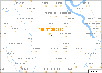
Chhota Kālia (Barisāl, Bangladesh)Chhota Kālia is a town in the Barisāl region of Bangladesh. An overview map of the region around Chhota Kālia is displayed below.
regional and 3d topo map of Chhota Kālia, Bangladesh ::
Chhota Kālia airports ::
The nearest airport is JSR - Jessore, located 51.8 km west of Chhota Kālia.
Other airports nearby include DAC - Dhaka Zia Intl (120.4 km north east), CCU - Calcutta Netaji Subhash Chandra Bose Intl (128.2 km west), IRD - Ishurdi (139.2 km north west), RJH - Rajshahi Shah Mokhdum (188.4 km north west), Nearby towns ::
Benda (2.5km north west) //
Kālia (3.7km north) //
Kalābāria (5.1km east) //
Bābupur (5.8km south) //
Pātna (6.3km north east) //
Kānduri (6.3km south east) //
Suktagrām (7.4km north) //
Māuli (7.6km north) //
Gāzikhāl (7.1km west) //
Peruli (7.1km west) //
Jungasia (7.6km south west) //
Ātlia (7.6km south east) //
Chorkhāli (9.0km north east) //
Purulia (8.8km north west) //
Khāsiāl (8.8km north east) //
[all distances 'as the bird flies' and approximate]  Places with similar names to Chhota Kālia, Bangladesh ::
// Chhota Gālua (BD)
// Chhota Kuli (BD)
// Chitākul (IN)
// Chitkal (IN)
// Chitkul (IN)
// Chitkūl (IN)
// Chatkal (UZ)
// Tiatgol (SN)
// Chitukula (ZM)
// Chitukulu (ZM)
Disclaimer :: Information on this page comes without warranty of any kind |
||
|
Where is Chhota Kālia? Elevation and coordinates ::
Latitude (lat): 23°1'0"N Longitude (lon): 89°38'0"E
Elevation (approx.): 4m (map arrows pan, magnifying glasses zoom) |
||
|
Visiting Chhota Kālia? Hotel/Accommodation ::
Book a hotel in Chhota Kālia Travel Guide ::
Buy a travel guide for Bangladesh rental cars ::
car rental offers GPS waypoint ::
download a GPX waypoint (PoI) of Chhota Kālia for your GPS receiver
|
||