|
search place name
|
||
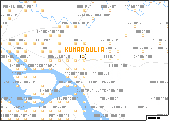
Kumārdulia (Barisāl, Bangladesh)Kumārdulia is a town in the Barisāl region of Bangladesh. An overview map of the region around Kumārdulia is displayed below.
regional and 3d topo map of Kumārdulia, Bangladesh ::
Kumārdulia airports ::
The nearest airport is IRD - Ishurdi, located 44.1 km north west of Kumārdulia.
Other airports nearby include JSR - Jessore (91.1 km south), RJH - Rajshahi Shah Mokhdum (98.0 km north west), DAC - Dhaka Zia Intl (99.2 km east), CCU - Calcutta Netaji Subhash Chandra Bose Intl (176.9 km south west), Nearby towns ::
Udaipur (0.0km north) //
Krordulia (0.0km north) //
Chandīpur (0.0km north) //
Kāzipur (1.9km north) //
Char Chaitrahāti (1.9km north) //
Banagrām (1.7km west) //
Berādulia (1.7km east) //
Darpāra (1.7km east) //
Mathurāpur (1.9km south) //
Baraipāra (1.9km south) //
Tāntibanda (2.5km north west) //
Chaitrahāti (2.5km north west) //
Padmabila (2.5km north east) //
Kumīrgāri (2.5km north east) //
Chhota Bangān (2.5km south west) //
Khānrpāra (2.5km south west) //
Pārbatia (2.5km south west) //
Niogir Bangaon (2.5km south west) //
Nandanpur (2.5km south west) //
Madhupur (2.5km south east) //
Rāmjibanpur (3.4km west) //
Bīl Bāisa (3.7km north) //
Nārāyanpur (3.7km south) //
Krishnapur (3.7km south) //
Jashmantadulia (3.4km east) //
Bīl Kula (4.1km north west) //
Khoksābāria (3.9km south west) //
Rādhānagar (4.1km south west) //
Bhairabpur (3.9km north east) //
[all distances 'as the bird flies' and approximate] 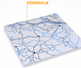 Places with similar names to Kumārdulia, Bangladesh ::
// Comerdale (US)
// Gombor Tuleh (ET)
// Gombor Uadel (ET)
// Qamar Tali (IQ)
// Camardelle (US)
// Komartala (BD)
// Gūmardalla (IN)
// Combourtillé (FR)
// Coomberdale (AU)
// Gomarduli (GE)
Disclaimer :: Information on this page comes without warranty of any kind |
||
|
Where is Kumārdulia? Elevation and coordinates ::
Latitude (lat): 23°58'0"N Longitude (lon): 89°26'0"E
Elevation (approx.): 11m (map arrows pan, magnifying glasses zoom) |
||
|
Visiting Kumārdulia? Hotel/Accommodation ::
Book a hotel in Kumārdulia Travel Guide ::
Buy a travel guide for Bangladesh rental cars ::
car rental offers GPS waypoint ::
download a GPX waypoint (PoI) of Kumārdulia for your GPS receiver
|
||