|
search place name
|
||
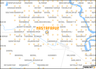
Mastafāpur (Barisāl, Bangladesh)Mastafāpur is a town in the Barisāl region of Bangladesh. An overview map of the region around Mastafāpur is displayed below.
regional and 3d topo map of Mastafāpur, Bangladesh ::
Mastafāpur airports ::
The nearest airport is JSR - Jessore, located 44.1 km south west of Mastafāpur.
Other airports nearby include IRD - Ishurdi (75.8 km north west), DAC - Dhaka Zia Intl (110.6 km east), RJH - Rajshahi Shah Mokhdum (125.9 km north west), CCU - Calcutta Netaji Subhash Chandra Bose Intl (135.5 km south west), Nearby towns ::
Padmabila (0.0km north) //
Ārālia Srīmantapur (0.0km north) //
Hāzipur (0.0km north) //
Mirzāpur (1.9km south) //
Hogaldānga Hridaypur (1.9km south) //
Kāsiādānga (1.9km south) //
Naldaha (1.7km east) //
West Bāriāla (1.7km east) //
Bishnupur (1.9km north) //
Baruichāra (1.9km north) //
Dhalfa Bagura (1.7km west) //
Phulbāri (1.9km north) //
Pātharghāta (1.7km west) //
North Mājāil (2.5km north west) //
Narihāti (3.7km south) //
East Bāriāla (3.4km east) //
Ārāisat (3.4km east) //
Ālidhāni (4.1km south east) //
Sibrāmpur (4.1km south east) //
Āthārakhāda (3.9km south east) //
Mithāpur (4.1km south west) //
Chandanpratāp (3.9km north east) //
Ālāipur (3.9km south west) //
Sāchāni Rāutāra (3.9km south west) //
Dosatina (4.1km north east) //
Barabila (4.1km north east) //
Ārāzi Tupipāra (4.1km north east) //
Srīrāmpur (3.9km north west) //
Rāmchandrapur (3.9km north west) //
[all distances 'as the bird flies' and approximate] 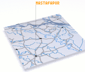 Places with similar names to Mastafāpur, Bangladesh ::
// Mastafāpur (BD)
// Mastafāpur (BD)
// Mastafāpur (BD)
// Mastafāpur (BD)
// Mastafāpur (BD)
// Mustafāpur (BD)
// Mustafāpur (BD)
// Mustafāpur (BD)
// Mustāfāpur (BD)
// Mustafāpur (PK)
Disclaimer :: Information on this page comes without warranty of any kind |
||
|
Where is Mastafāpur? Elevation and coordinates ::
Latitude (lat): 23°32'0"N Longitude (lon): 89°22'0"E
Elevation (approx.): 16m (map arrows pan, magnifying glasses zoom) |
||
|
Visiting Mastafāpur? Hotel/Accommodation ::
Book a hotel in Mastafāpur Travel Guide ::
Buy a travel guide for Bangladesh rental cars ::
car rental offers GPS waypoint ::
download a GPX waypoint (PoI) of Mastafāpur for your GPS receiver
|
||