|
search place name
|
||
Sālāmatpur (Barisāl, Bangladesh)Sālāmatpur is a town in the Barisāl region of Bangladesh. An overview map of the region around Sālāmatpur is displayed below.
regional and 3d topo map of Sālāmatpur, Bangladesh ::

Sālāmatpur airports ::
The nearest airport is JSR - Jessore, located 53.0 km south west of Sālāmatpur.
Other airports nearby include IRD - Ishurdi (86.0 km north west), DAC - Dhaka Zia Intl (95.3 km north east), RJH - Rajshahi Shah Mokhdum (138.2 km north west), CCU - Calcutta Netaji Subhash Chandra Bose Intl (146.6 km south west), Nearby towns ::
Hānchla (0.0km north) //
Bādiādāngi (0.0km north) //
Maslandapur (1.7km west) //
Char Sālāmatpur (1.9km south) //
Komarpur (1.7km east) //
Majail Madartala (2.5km north west) //
Sapalgācha (2.5km north west) //
Rājādharpur (2.5km north west) //
Ārpāra Gariādaha (2.5km north east) //
Kāmārkhāli Ghāt (2.5km north east) //
Harinādānga (2.5km south east) //
Chālmia (2.5km south east) //
Saildubi (3.4km west) //
Dhuljora (3.7km south) //
Dumursia (3.7km south) //
Gomara (3.4km east) //
Chhota Gopāldi (3.4km east) //
North Gobindapur (3.9km north west) //
Kāsundi (3.9km north west) //
Sonāpukurpār (3.9km north west) //
Nischintāpur (4.1km north west) //
Sarbāj (3.9km south west) //
Char Sālāmatpur (3.9km south west) //
Ārpāra (3.9km south west) //
Bahalbāria (4.1km south west) //
Churārgānti (4.1km south west) //
Kalaikānda Ujāndia (3.9km north east) //
Mitāin (3.9km south east) //
Rāinagar (5.0km north west) //
[all distances 'as the bird flies' and approximate] 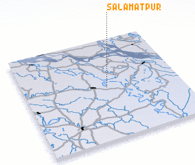 Places with similar names to Sālāmatpur, Bangladesh ::
// Selāmatpur (BD)
// Salāmatpur (IN)
// Salāmatpur (PK)
// Salāmatpur (PK)
// Salāmatpura (PK)
// Salāmatpura (PK)
// Salma Tappare (NG)
Disclaimer :: Information on this page comes without warranty of any kind |
||
|
Where is Sālāmatpur? Elevation and coordinates ::
Latitude (lat): 23°31'0"N Longitude (lon): 89°32'0"E
Elevation (approx.): 13m (map arrows pan, magnifying glasses zoom) |
||
|
Visiting Sālāmatpur? Hotel/Accommodation ::
Book a hotel in Sālāmatpur Travel Guide ::
Buy a travel guide for Bangladesh rental cars ::
car rental offers GPS waypoint ::
download a GPX waypoint (PoI) of Sālāmatpur for your GPS receiver
|
||