|
search place name
|
||
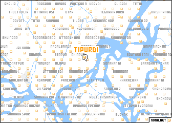
Tipurdi (Dhaka, Bangladesh)Tipurdi is a town in the Dhaka region of Bangladesh. An overview map of the region around Tipurdi is displayed below.
regional and 3d topo map of Tipurdi, Bangladesh ::
Tipurdi airports ::
The nearest airport is DAC - Dhaka Zia Intl, located 31.0 km north west of Tipurdi.
Other airports nearby include IXA - Agartala (69.2 km north east), JSR - Jessore (157.1 km west), IXH - Kailashahar (159.6 km north east), IRD - Ishurdi (168.9 km west), Nearby towns ::
Bāri Shyāmkumār (0.5km north east) //
Bāri Srīrām (0.5km north east) //
Paschim Gopālpatti (0.5km north east) //
Sonārgaon (0.5km north east) //
Bhattapur (0.5km north east) //
Lakshmīpura (0.5km north east) //
Purba Gopālpatti (0.5km north east) //
Nayābāzār (0.5km north east) //
Pānām Gābtali (0.5km north east) //
Sāhāpur (0.5km north east) //
Ranbhowāl Gobindapur (0.5km north east) //
Sibnagar (0.5km north east) //
Sātbhāipāra (0.5km north east) //
Bāri Rāmkrishnapur (0.5km north east) //
Dakshin Sollāpāra (0.5km north east) //
Jayrāmpur (0.5km north east) //
Krishnapura (0.5km north east) //
Bhiti Gobindapur (0.5km north east) //
Baidyer Bāzār (0.5km north east) //
Fatehkāndi (0.5km north east) //
Noāil (0.5km north east) //
Chak Sonārgaon (0.5km north east) //
Bāzār Āminpur (0.5km north east) //
Khāgātia (0.5km north east) //
Chhayhisya (1.5km south) //
Bānināthpur (1.5km south) //
Bhātibanda (1.5km south) //
Diāra Menikhāli (1.5km south) //
Khorda Chaudāna (1.5km west) //
[all distances 'as the bird flies' and approximate]  Places with similar names to Tipurdi, Bangladesh ::
Disclaimer :: Information on this page comes without warranty of any kind |
||
|
Where is Tipurdi? Elevation and coordinates ::
Latitude (lat): 23°38'48"N Longitude (lon): 90°36'50"E
Elevation (approx.): 10m (map arrows pan, magnifying glasses zoom) |
||
|
Visiting Tipurdi? Hotel/Accommodation ::
Book a hotel in Tipurdi Travel Guide ::
Buy a travel guide for Bangladesh rental cars ::
car rental offers GPS waypoint ::
download a GPX waypoint (PoI) of Tipurdi for your GPS receiver
|
||