|
search place name
|
||
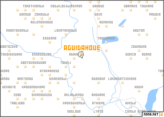
Aguidahoué (Benin)Aguidahoué is a town in Benin. An overview map of the region around Aguidahoué is displayed below.
regional and 3d topo map of Aguidahoué, Benin ::
Aguidahoué airports ::
The nearest airport is LFW - Lome Gnassingbe Eyadema Intl, located 71.0 km south west of Aguidahoué.
Other airports nearby include COO - Cotonou Cadjehoun (90.6 km south east), LOS - Lagos Murtala Muhammed (187.0 km east), ACC - Accra Kotoka Intl (232.2 km south west), Nearby towns ::
Adamé (1.8km west) //
Dondji-Zouin (1.9km north) //
Tokpli (2.6km south west) //
Tokpli (4.1km south west) //
Amédenta (4.1km north east) //
Adjiga (4.1km north east) //
Adabyaou (5.2km south west) //
Doumassi Kondji (5.9km south) //
Ouédémè (5.8km east) //
Lakata Kondji (6.7km north west) //
Adohoun (6.7km south east) //
Tangaramé (6.7km north east) //
Bémina Kondji (7.6km west) //
Ounsouvi (7.8km south west) //
Sika Kondji (7.8km south west) //
Atakpamédé (8.2km south west) //
Essé Ana (8.2km north west) //
Niavo (8.3km north east) //
Meboudanou Kondji (9.2km south west) //
Afadonou (9.2km south west) //
Agnavou (9.2km north east) //
Assou Kondji (10.4km south west) //
[all distances 'as the bird flies' and approximate] 
Disclaimer :: Information on this page comes without warranty of any kind |
||
|
Where is Aguidahoué? Elevation and coordinates ::
Latitude (lat): 6°41'0"N Longitude (lon): 1°38'0"E
Elevation (approx.): 21m (map arrows pan, magnifying glasses zoom) |
||
|
Visiting Aguidahoué? Hotel/Accommodation ::
Book a hotel in Aguidahoué Travel Guide ::
Buy a travel guide for Benin rental cars ::
car rental offers GPS waypoint ::
download a GPX waypoint (PoI) of Aguidahoué for your GPS receiver
|
||