|
search place name
|
||
Rassomdé (Burkina Faso)Rassomdé is a town in Burkina Faso. An overview map of the region around Rassomdé is displayed below.
regional and 3d topo map of Rassomdé, Burkina Faso ::

Rassomdé airports ::
The nearest airport is OUA - Ouagadougou, located 113.9 km south east of Rassomdé.
Other airports nearby include MZI - Mopti Ambodedjo (256.7 km north west), Nearby towns ::
Kelgueme (2.6km south west) //
Tougo (2.6km north east) //
Mangoulma (3.7km south) //
Rasko (5.2km north west) //
Rima (5.7km east) //
Rikiba (5.8km south) //
Lébanga (6.6km north east) //
Béranga (7.4km south) //
Gouria (7.5km east) //
Danawa (7.6km north) //
Komtoega (8.2km south west) //
Kindiba (8.1km north west) //
Touko (9.2km south east) //
Banguessommba (9.1km south west) //
Guiri Guiri (10.3km north west) //
[all distances 'as the bird flies' and approximate] 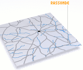 Places with similar names to Rassomdé, Burkina Faso ::
// Rosemead (US)
// Roy Summit (US)
// Rizómata (GR)
// Rosemead (US)
// Rassomdé (BF)
// Rozi Māta (IN)
// Raīs Ahmad (PK)
// Rosmead (ZA)
// Razimet (FR)
// Razmety (RU)
Disclaimer :: Information on this page comes without warranty of any kind |
||
|
Where is Rassomdé? Elevation and coordinates ::
Latitude (lat): 13°11'0"N Longitude (lon): 2°8'0"W
Elevation (approx.): 321m (map arrows pan, magnifying glasses zoom) |
||
|
Visiting Rassomdé? Hotel/Accommodation ::
Book a hotel in Rassomdé Travel Guide ::
rental cars ::
car rental offers GPS waypoint ::
download a GPX waypoint (PoI) of Rassomdé for your GPS receiver
|
||