|
search place name
|
||
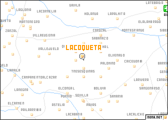
La Coqueta (Valle del Cauca, Colombia)La Coqueta is a town in the Valle del Cauca region of Colombia. An overview map of the region around La Coqueta is displayed below.
regional and 3d topo map of La Coqueta, Colombia ::
La Coqueta airports ::
The nearest airport is AXM - Armenia El Eden, located 21.7 km north east of La Coqueta.
Other airports nearby include ULQ - Tulua Farfan (44.3 km south west), PEI - Pereira Matecana (55.5 km north east), IBE - Ibague Perales (89.2 km east), MZL - Manizales La Nubia (91.4 km north east), Nearby towns ::
Manzanillo (1.9km south) //
La Cuchilla (1.8km west) //
Quebradanueva (2.6km north west) //
Tres Esquinas (3.7km south) //
El Jardín (3.7km north) //
Palmichal (4.1km north east) //
Manzano (5.2km south east) //
Sabanazo (5.2km north east) //
Totoró (5.2km south west) //
Palomino (5.8km east) //
Corozal (6.7km north east) //
El Venado (7.4km east) //
Vallejuelo (7.9km west) //
Bolivia (8.3km south east) //
El Congal (8.3km south west) //
Villa Eugenia (9.7km north west) //
[all distances 'as the bird flies' and approximate] 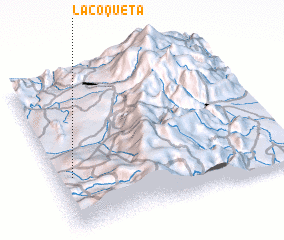 Places with similar names to La Coqueta, Colombia ::
// La Coqueta (CO)
// Likokoto (ZM)
// Likokoto (ZM)
// Lukokoda (TZ)
// La Cagüita (VE)
// La Goguette (GP)
// Lugqod (SO)
// Lakai Kota (PK)
// Loccota (AU)
// Laikakota (BO)
Disclaimer :: Information on this page comes without warranty of any kind |
||
|
Where is La Coqueta? Elevation and coordinates ::
Latitude (lat): 4°21'0"N Longitude (lon): 75°56'0"W
Elevation (approx.): 1279m (map arrows pan, magnifying glasses zoom) |
||
|
Visiting La Coqueta? Hotel/Accommodation ::
Book a hotel in La Coqueta Travel Guide ::
Buy a travel guide for Colombia rental cars ::
car rental offers GPS waypoint ::
download a GPX waypoint (PoI) of La Coqueta for your GPS receiver
|
||