|
search place name
|
||
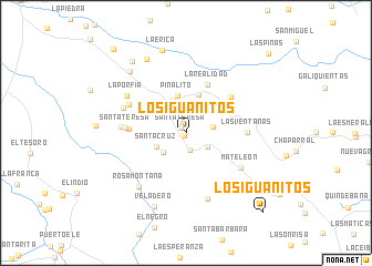
Los Iguanitos (Departamento de Arauca, Colombia)Los Iguanitos is a town in the Departamento de Arauca region of Colombia. An overview map of the region around Los Iguanitos is displayed below.
regional and 3d topo map of Los Iguanitos, Colombia ::
Los Iguanitos airports ::
The nearest airport is AUC - Arauca Santiago Perez, located 45.2 km north of Los Iguanitos.
Other airports nearby include TME - Tame (130.9 km west), STD - Santo Domingo Mayor Buenaventura Vivas (186.1 km north west), BNS - Barinas (218.2 km north), MRD - Merida Alberto Carnevalli (219.0 km north), Nearby towns ::
Pardillal (0.3km south west) //
Santa Teresa (0.7km north west) //
Rascador (1.8km south) //
Morichal (2.6km south east) //
El Tigre (2.8km east) //
Mapurite (3.0km south west) //
Santa Cruz (3.2km south west) //
Santa Isabel (3.3km north west) //
Maporillal (3.5km north) //
Piñalito (3.8km north) //
El Trompillo (4.1km north) //
La Realidad (5.3km north east) //
San Rafael (5.7km west) //
Campo Alegre (5.8km north east) //
Santa Teresa (6.1km west) //
Las Ventanas (6.1km east) //
Buenos Aires (6.4km north west) //
Los Placeres (6.5km west) //
Mateleón (6.5km south east) //
Las Tres Eras (6.8km west) //
La Porfía (7.0km north west) //
Guayabital (7.0km south) //
Rosa Montaña (7.2km south west) //
Veladero (8.1km south west) //
Santa Bárbara (8.3km north west) //
Las Palmas (8.4km north west) //
La Erica (8.7km north) //
Nueva Zelandia (9.0km north west) //
Los Iguanitos (11.1km south east) //
[all distances 'as the bird flies' and approximate] 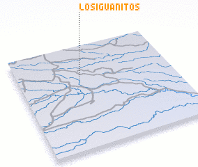 Places with similar names to Los Iguanitos, Colombia ::
// Los Cantos (PA)
// Los Segundos (PA)
// Las Cañadas (ES)
// Las Cañadas (ES)
// Las Cañadas (ES)
// Las Cañadas (ES)
// Las Cañadas (ES)
// Las Cañadas (ES)
// Las Cañadas (ES)
// Los Cantos (ES)
Disclaimer :: Information on this page comes without warranty of any kind |
||
|
Where is Los Iguanitos? Elevation and coordinates ::
Latitude (lat): 6°41'0"N Longitude (lon): 70°36'0"W
Elevation (approx.): 117m (map arrows pan, magnifying glasses zoom) |
||
|
Visiting Los Iguanitos? Hotel/Accommodation ::
Book a hotel in Los Iguanitos Travel Guide ::
Buy a travel guide for Colombia rental cars ::
car rental offers GPS waypoint ::
download a GPX waypoint (PoI) of Los Iguanitos for your GPS receiver
|
||