|
search place name
|
||
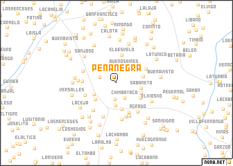
Peña Negra (Huila, Colombia)Peña Negra is a town in the Huila region of Colombia. An overview map of the region around Peña Negra is displayed below.
regional and 3d topo map of Peña Negra, Colombia ::
Peña Negra airports ::
The nearest airport is FLA - Florencia Gustavo Artunduaga Paredes, located 83.0 km south of Peña Negra.
Other airports nearby include PPN - Popayan Guillermo Leon Valencia (91.2 km west), NVA - Neiva Benito Salas (91.5 km north east), SVI - San Vincente De Caguan Eduardo Falla Solano (116.5 km east), CLO - Cali Alfonso Bonilla Aragon Intl (151.7 km north west), Nearby towns ::
San Luis (2.7km south) //
Chimbayaco (2.8km south east) //
La Ermita (2.8km west) //
Villa Rosa (2.9km north east) //
Buenos Aires (2.9km north east) //
Pital (3.7km south) //
El Chorrillo (4.1km south west) //
Sabaneta (4.1km east) //
La Esperanza (4.3km south west) //
El Carmen (4.4km south) //
Providencia (4.4km south east) //
La Betulia (4.4km east) //
Mercedes (4.6km south east) //
El Desvelo (4.6km north) //
Jericó (5.2km south) //
Montecitos (5.3km north east) //
Canoas (5.4km west) //
La Alemana (5.4km west) //
Suiza (5.7km south) //
El Uvital (5.7km west) //
Quebrada El Cusco (5.8km south) //
Agrado (5.8km south east) //
El Higuerón (5.8km south west) //
Flor Amarilla (5.9km south) //
La Galguita (6.0km south) //
El Cauchal (6.2km west) //
El Kiosko (6.4km south east) //
El Estoraque (6.6km north) //
San José (6.7km north west) //
[all distances 'as the bird flies' and approximate] 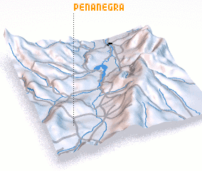 Places with similar names to Peña Negra, Colombia ::
// Poiana Negrii (RO)
// Pānānagar (BD)
// Puniānagar (BD)
// Peña Negra (CO)
// Peña Negra (CO)
// Peña Negra (MX)
// Panangar (SN)
// Peña Negra (PE)
// Peñanegra (PE)
// Peña Negra (VE)
Disclaimer :: Information on this page comes without warranty of any kind |
||
|
Where is Peña Negra? Elevation and coordinates ::
Latitude (lat): 2°18'1"N Longitude (lon): 75°48'13"W
Elevation (approx.): 1671m (map arrows pan, magnifying glasses zoom) |
||
|
Visiting Peña Negra? Hotel/Accommodation ::
Book a hotel in Peña Negra Travel Guide ::
Buy a travel guide for Colombia rental cars ::
car rental offers GPS waypoint ::
download a GPX waypoint (PoI) of Peña Negra for your GPS receiver
|
||