|
search place name
|
||
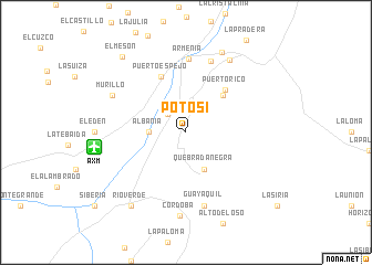
Potosí (Caldas, Colombia)Potosí is a town in the Caldas region of Colombia. An overview map of the region around Potosí is displayed below.
regional and 3d topo map of Potosí, Colombia ::
Potosí airports ::
The nearest airport is AXM - Armenia El Eden, located 9.4 km west of Potosí.
Other airports nearby include PEI - Pereira Matecana (38.8 km north), IBE - Ibague Perales (61.2 km east), MZL - Manizales La Nubia (66.8 km north), ULQ - Tulua Farfan (74.2 km south west), Nearby towns ::
El Caimo (2.6km north west) //
La Española (2.6km north west) //
Albania (3.7km west) //
Quebradanegra (4.1km south east) //
La Virginia (5.2km north east) //
Puerto Rico (5.8km north east) //
Puerto Espejo (6.2km north west) //
Armenia (7.5km north) //
La María (7.6km north) //
Guayaquil (7.6km south) //
Murillo (8.3km north west) //
Córdoba (8.5km south) //
Calarcá (8.5km north east) //
Alto del Río (8.9km north east) //
Ríoverde (9.3km south west) //
El Mesón (9.9km north west) //
[all distances 'as the bird flies' and approximate] 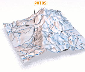 Places with similar names to Potosí, Colombia ::
Disclaimer :: Information on this page comes without warranty of any kind |
||
|
Where is Potosí? Elevation and coordinates ::
Latitude (lat): 4°28'0"N Longitude (lon): 75°41'0"W
Elevation (approx.): 1395m (map arrows pan, magnifying glasses zoom) |
||
|
Visiting Potosí? Hotel/Accommodation ::
Book a hotel in Potosí Travel Guide ::
Buy a travel guide for Colombia rental cars ::
car rental offers GPS waypoint ::
download a GPX waypoint (PoI) of Potosí for your GPS receiver
|
||