|
search place name
|
||
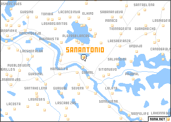
San Antonio (Magdalena, Colombia)San Antonio is a town in the Magdalena region of Colombia. An overview map of the region around San Antonio is displayed below.
regional and 3d topo map of San Antonio, Colombia ::
San Antonio airports ::
The nearest airport is MGN - Magangue Baracoa, located 68.0 km west of San Antonio.
Other airports nearby include CZU - Corozal Las Brujas (116.5 km west), OCV - Ocana Aguas Claras (135.9 km south east), VUP - Valledupar Alfonso Lopez Pumarejo (176.0 km north east), MTR - Monteria Los Garzones (179.2 km west), Nearby towns ::
Pampán (1.5km south west) //
La Ceiba (2.0km north east) //
Botón de Leiva (3.1km south west) //
La Pedregosa (3.1km north) //
Guamal (3.7km south) //
La Estrella (3.8km north) //
Bellavista (4.4km north) //
La Puntica (4.4km north) //
Playas Blancas (4.8km north west) //
Bellavista (5.2km north east) //
Guamo (5.2km south east) //
Puerto Rangel (5.3km west) //
Sandoval (5.4km south) //
Murillo (5.5km west) //
Los Trapiches (5.8km south) //
Hato Viejo (5.8km north) //
Sitio Nuevo (5.8km south east) //
Margarita (6.2km south west) //
Si Pudiere (6.3km north) //
La Esperanza (6.6km north west) //
Ricaurte (6.9km north) //
Salvadora (7.0km east) //
Se Verá (7.2km south) //
Chilloa (7.4km south) //
Venero (7.8km north) //
María Antonia (7.8km north) //
La Esperanza (8.1km north east) //
Buenavista (8.6km north west) //
Guadual (8.7km south west) //
[all distances 'as the bird flies' and approximate] 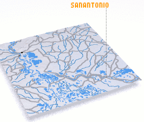 Places with similar names to San Antonio, Colombia ::
// San Antônio (BR)
// San Antonio (BZ)
// San Antonio (BZ)
// San Antonio (BZ)
// San Antonio (BZ)
// San Antonio (US)
// San Antonio (US)
// San Antonio (US)
// San Antonio (PA)
// San Antonio (PA)
Disclaimer :: Information on this page comes without warranty of any kind |
||
|
Where is San Antonio? Elevation and coordinates ::
Latitude (lat): 9°10'48"N Longitude (lon): 74°14'10"W
Elevation (approx.): 27m (map arrows pan, magnifying glasses zoom) |
||
|
Visiting San Antonio? Hotel/Accommodation ::
Book a hotel in San Antonio Travel Guide ::
Buy a travel guide for Colombia rental cars ::
car rental offers GPS waypoint ::
download a GPX waypoint (PoI) of San Antonio for your GPS receiver
|
||