|
search place name
|
||
San Joaquín (Valle del Cauca, Colombia)San Joaquín is a town in the Valle del Cauca region of Colombia. An overview map of the region around San Joaquín is displayed below.
regional and 3d topo map of San Joaquín, Colombia ::

San Joaquín airports ::
The nearest airport is CLO - Cali Alfonso Bonilla Aragon Intl, located 20.5 km south of San Joaquín.
Other airports nearby include ULQ - Tulua Farfan (42.0 km north), BUN - Buenaventura Gerardo Tobar Lopez (72.4 km west), AXM - Armenia El Eden (103.0 km north east), PEI - Pereira Matecana (137.8 km north east), Nearby towns ::
San Rafael (0.8km west) //
Jerico Retilo (1.0km east) //
El Tesore (1.1km south east) //
Monte Oscuro (1.8km north west) //
Soledad (1.9km north east) //
San Fernando (2.2km south) //
San Carlos (2.5km south west) //
San Lorenzo (2.8km north) //
San Luis (2.9km south east) //
Santa Inés (3.0km south east) //
Milan (3.0km south west) //
El Palmar (3.2km west) //
La Cristalina (3.3km south east) //
Zabaletas (3.3km south east) //
El Arbolito (3.4km south east) //
La Matilde (3.4km north west) //
Trapiche (3.4km south) //
El Cairo (3.6km north east) //
San Antonio (3.8km south) //
San Miguel (3.8km west) //
San Fernando (3.9km south) //
La Naranja (3.9km north) //
El Carmen (3.9km east) //
La Lucha (3.9km south west) //
La Quesería (4.1km south west) //
La Monte Oscuro (4.2km south west) //
Aquablanca (4.2km south) //
Zanjón Pampamá (4.2km south) //
San Antonio (4.3km east) //
[all distances 'as the bird flies' and approximate] 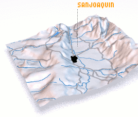 Places with similar names to San Joaquín, Colombia ::
// San Joaquin (BZ)
// San Joaquin (US)
// San Joaquín (PA)
// San Joaquín (CU)
// San Joaquín (CU)
// San Joaquín (CU)
// San Joaquín (CU)
// San Joaquín (CU)
// San Joaquín (CU)
// San Joaquín (CU)
Disclaimer :: Information on this page comes without warranty of any kind |
||
|
Where is San Joaquín? Elevation and coordinates ::
Latitude (lat): 3°43'30"N Longitude (lon): 76°20'41"W
Elevation (approx.): 966m (map arrows pan, magnifying glasses zoom) |
||
|
Visiting San Joaquín? Hotel/Accommodation ::
Book a hotel in San Joaquín Travel Guide ::
Buy a travel guide for Colombia rental cars ::
car rental offers GPS waypoint ::
download a GPX waypoint (PoI) of San Joaquín for your GPS receiver
|
||