|
search place name
|
||
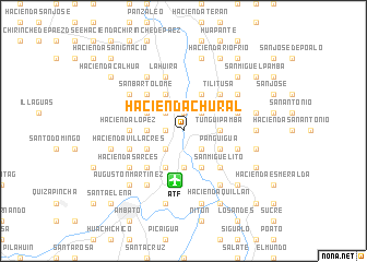
Hacienda Chural (Tungurahua, Ecuador)Hacienda Chural is a town in the Tungurahua region of Ecuador. An overview map of the region around Hacienda Chural is displayed below.
regional and 3d topo map of Hacienda Chural, Ecuador ::
Hacienda Chural airports ::
The nearest airport is ATF - Ambato Chachoan, located 5.1 km south of Hacienda Chural.
Other airports nearby include UIO - Quito Mariscal Sucre Intl (113.7 km north), XMS - Macas Coronel E Carvajal (134.7 km south), GYE - Guayaquil Jose Joaquin De Olmedo Intl (183.0 km south west), OCC - Coca Francisco De Orellana (192.3 km north east), Nearby towns ::
Hacienda Barberis (1.9km west) //
Patzocul (1.9km north) //
Puerto Arturo (2.6km south west) //
Hacienda Naranjo (2.6km south west) //
Hacienda de Rosa Barona (2.6km south west) //
Hacienda La Florida (2.6km south east) //
Cushca (2.6km south east) //
Hacienda Cunchibamba (2.6km north west) //
Hacienda La Joya (2.6km north west) //
Rosales (2.6km north west) //
Hacienda Saquitusa (2.6km north east) //
Presidente Urbina (2.6km north east) //
Hacienda de Tinajero (3.7km west) //
Hacienda Unamuncho (3.7km west) //
Hacienda de Jáuregui (3.7km south) //
Tunguipamba (3.7km east) //
Píllaro (3.7km east) //
Píllaro Nuevo (3.7km east) //
Hacienda El Carmen (3.7km east) //
Hacienda Samanga de Sevilla (4.1km south west) //
Hacienda Patulata (4.1km south west) //
Hacienda Pisque (4.1km south west) //
Hacienda Chasinata (4.1km south west) //
Hacienda San Pablo (4.1km north west) //
Hacienda El Conde (4.1km north west) //
Hacienda Panguigua (4.1km south east) //
Panguigua (4.1km south east) //
Cushca Chico (4.1km south east) //
Cunchibamba (4.1km north west) //
[all distances 'as the bird flies' and approximate] 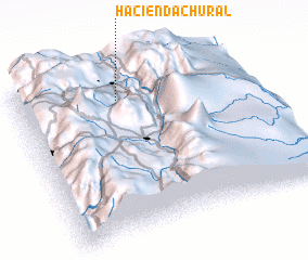 Places with similar names to Hacienda Chural, Ecuador ::
// Hacienda Achiral (EC)
// Hacienda Charla (EC)
Disclaimer :: Information on this page comes without warranty of any kind |
||
|
Where is Hacienda Chural? Elevation and coordinates ::
Latitude (lat): 1°10'0"S Longitude (lon): 78°34'0"W
Elevation (approx.): 2659m (map arrows pan, magnifying glasses zoom) |
||
|
Visiting Hacienda Chural? Hotel/Accommodation ::
Book a hotel in Hacienda Chural Travel Guide ::
Buy a travel guide for Ecuador rental cars ::
car rental offers GPS waypoint ::
download a GPX waypoint (PoI) of Hacienda Chural for your GPS receiver
|
||