|
search place name
|
||
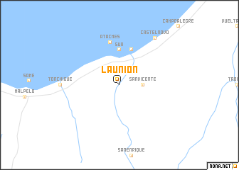
La Unión (Esmeraldas, Ecuador)La Unión is a town in the Esmeraldas region of Ecuador. An overview map of the region around La Unión is displayed below.
regional and 3d topo map of La Unión, Ecuador ::
La Unión airports ::
The nearest airport is TCO - Tumaco La Florida, located 166.2 km north east of La Unión.
Other airports nearby include UIO - Quito Mariscal Sucre Intl (186.4 km south east), MEC - Manta Eloy Alfaro Intl (214.9 km south west), PVO - Portoviejo Reales Tamarindos (216.3 km south), GPI - Guapi Juan Casiano (292.5 km north east), Nearby towns ::
San Vicente (3.7km east) //
Súa (5.6km north) //
Atacames (5.9km north) //
Atacmes (6.9km north) //
Castelnovo (9.3km north east) //
[all distances 'as the bird flies' and approximate] 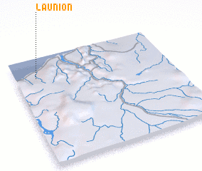 Places with similar names to La Unión, Ecuador ::
Disclaimer :: Information on this page comes without warranty of any kind |
||
|
Where is La Unión? Elevation and coordinates ::
Latitude (lat): 0°49'0"S Longitude (lon): 79°52'0"W
Elevation (approx.): 16m (map arrows pan, magnifying glasses zoom) |
||
|
Visiting La Unión? Hotel/Accommodation ::
Book a hotel in La Unión Travel Guide ::
Buy a travel guide for Ecuador rental cars ::
car rental offers GPS waypoint ::
download a GPX waypoint (PoI) of La Unión for your GPS receiver
|
||