|
search place name
|
||
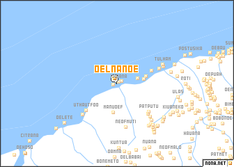
Oelnanoe (Timor Timur, East Timor)Oelnanoe is a town in the Timor Timur region of East Timor. An overview map of the region around Oelnanoe is displayed below.
regional and 3d topo map of Oelnanoe, East Timor ::
Oelnanoe airports ::
The nearest airport is DIL - Dili Presidente Nicolau Lobato Intl, located 163.2 km north east of Oelnanoe.
Nearby towns ::
Kabana (0.4km north east) //
Fuabana (0.6km west) //
Bokon (0.8km north east) //
Kabukpele (3.4km east) //
Maquelab (4.3km east) //
Manuoef (4.6km south) //
Fuin (4.7km east) //
Tuinmolo (5.8km east) //
Uthautfoo (6.6km south west) //
Patputu (6.8km south east) //
Patoke (6.9km south east) //
Neofmuti (7.1km south) //
Najalu (7.1km east) //
Bonak (7.4km south west) //
Kuanata (7.5km south east) //
Taosero (7.9km east) //
Tulham (7.9km north east) //
Kuapal (8.0km south east) //
Kanael (8.4km south east) //
Bititim (8.4km south east) //
Poasbot (8.7km south east) //
Tulaika (8.7km east) //
Nuheo (9.0km south east) //
Upsena (9.2km south east) //
Oelkaem (9.3km south east) //
Buinsapi (9.3km south east) //
Nemun (9.3km south east) //
Noahluku (9.4km south east) //
Neopnua (9.4km south east) //
[all distances 'as the bird flies' and approximate] 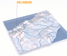 Places with similar names to Oelnanoe, East Timor ::
Disclaimer :: Information on this page comes without warranty of any kind |
||
|
Where is Oelnanoe? Elevation and coordinates ::
Latitude (lat): 9°14'40"S Longitude (lon): 124°13'2"E
Elevation (approx.): 10m (map arrows pan, magnifying glasses zoom) |
||
|
Visiting Oelnanoe? Hotel/Accommodation ::
Book a hotel in Oelnanoe Travel Guide ::
Buy a travel guide for East Timor rental cars ::
car rental offers GPS waypoint ::
download a GPX waypoint (PoI) of Oelnanoe for your GPS receiver
|
||