|
search place name
|
||
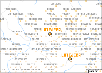
La Tejera (Baja Verapaz, Guatemala)La Tejera is a town in the Baja Verapaz region of Guatemala. An overview map of the region around La Tejera is displayed below.
regional and 3d topo map of La Tejera, Guatemala ::
La Tejera airports ::
The nearest airport is GUA - Guatemala City La Aurora, located 37.0 km south of La Tejera.
Other airports nearby include CBV - Coban (63.0 km north), TAP - Tapachula Intl (196.3 km west), SAL - San Salvador El Salvador Intl (229.5 km south east), Nearby towns ::
Casas Viejas (0.0km north) //
Los Limones (0.0km north) //
Las Dantas (0.0km north) //
El Guapinol (1.8km south east) //
Coyol Seco (1.9km north) //
Palo Corcovado (1.9km north) //
San Diego (1.9km south) //
Ciénaga Larga (1.8km west) //
El Oratorio (2.6km north east) //
Trapichito (2.6km north east) //
Llano Grande (2.6km north west) //
Santa Rita (2.6km south east) //
Potrero Grande (2.6km south east) //
Granados (2.9km east) //
San Antonio (3.6km east) //
Las Cuevas de Llano Grande (3.7km north) //
Los Cimientos (3.7km north) //
Buen Retiro (3.6km west) //
El Conacaste (4.0km north east) //
Rancho de Teja (4.0km north west) //
San José Suchicul (4.0km south east) //
Santa Rosa (4.0km south east) //
Agua Caliente (4.1km north east) //
La Estanzuela (4.0km south west) //
Los Cerritos (4.0km south west) //
El Chaparro (4.0km south west) //
Estancia de García (4.1km south west) //
Quichumil (4.1km south east) //
Los Pozos (5.2km south west) //
[all distances 'as the bird flies' and approximate] 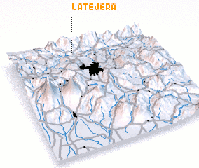 Places with similar names to La Tejera, Guatemala ::
// Laudigerie (FR)
// Laudigerie (FR)
// Leitgiriai (LT)
// La Tejera (ES)
// La Tejera (ES)
// La Tejera (ES)
// La Tejera (ES)
// Lletger (ES)
// La Tejería (EC)
// La Tejera (GT)
Disclaimer :: Information on this page comes without warranty of any kind |
||
|
Where is La Tejera? Elevation and coordinates ::
Latitude (lat): 14°55'0"N Longitude (lon): 90°33'0"W
Elevation (approx.): 1165m (map arrows pan, magnifying glasses zoom) |
||
|
Visiting La Tejera? Hotel/Accommodation ::
Book a hotel in La Tejera Travel Guide ::
Buy a travel guide for Guatemala rental cars ::
car rental offers GPS waypoint ::
download a GPX waypoint (PoI) of La Tejera for your GPS receiver
|
||