|
search place name
|
||
San José Nil Chiquito (Retalhuleu, Guatemala)San José Nil Chiquito is a town in the Retalhuleu region of Guatemala. An overview map of the region around San José Nil Chiquito is displayed below.
regional and 3d topo map of San José Nil Chiquito, Guatemala ::

San José Nil Chiquito airports ::
The nearest airport is TAP - Tapachula Intl, located 71.1 km north west of San José Nil Chiquito.
Other airports nearby include GUA - Guatemala City La Aurora (133.7 km east), CBV - Coban (179.2 km north east), Nearby towns ::
Sibaná (4.1km north east) //
Jerez (4.0km north east) //
San Miguelito (5.2km north west) //
Las Ánimas (5.2km north west) //
Xab (5.6km north) //
Ayutilla (5.7km east) //
Las Cruces (6.6km south west) //
El Castaño (7.2km west) //
Concepción Nil (7.7km north east) //
Vaquilito (7.7km south east) //
El Recuerdo (8.2km south east) //
Xulá Copepé (8.1km south east) //
Cabañas (8.1km north east) //
El Asintal (8.2km north east) //
La Paz (9.1km north west) //
Caballo Blanco (9.1km south west) //
Nuevo San Carlos (10.3km north east) //
[all distances 'as the bird flies' and approximate] 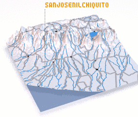 Places with similar names to San José Nil Chiquito, Guatemala :: Disclaimer :: Information on this page comes without warranty of any kind |
||
|
Where is San José Nil Chiquito? Elevation and coordinates ::
Latitude (lat): 14°32'0"N Longitude (lon): 91°46'0"W
Elevation (approx.): 154m (map arrows pan, magnifying glasses zoom) |
||
|
Visiting San José Nil Chiquito? Hotel/Accommodation ::
Book a hotel in San José Nil Chiquito Travel Guide ::
Buy a travel guide for Guatemala rental cars ::
car rental offers GPS waypoint ::
download a GPX waypoint (PoI) of San José Nil Chiquito for your GPS receiver
|
||