|
search place name
|
||
Santa Rita (Jutiapa, Guatemala)Santa Rita is a town in the Jutiapa region of Guatemala. An overview map of the region around Santa Rita is displayed below.
regional and 3d topo map of Santa Rita, Guatemala ::

Santa Rita airports ::
The nearest airport is GUA - Guatemala City La Aurora, located 83.0 km west of Santa Rita.
Other airports nearby include CBV - Coban (130.5 km north west), SAL - San Salvador El Salvador Intl (137.0 km south east), SAP - San Pedro Sula La Mesa Intl (226.3 km north east), Nearby towns ::
San Nicolás (0.0km north) //
San Miguel (1.8km west) //
San Isidro (1.8km west) //
Santa María (1.9km north) //
Barranca Honda (1.9km south) //
Brasilar (1.8km east) //
La Arada (2.6km south west) //
El Jocotillo (2.6km north east) //
Natividad (2.6km north east) //
Santa Catarina Mita (2.6km south east) //
Pinalito (3.7km north) //
Llano de Chinchilla (3.6km east) //
Buena Vista (3.6km east) //
Potrero Grande (4.0km north west) //
El Tanque (4.1km north east) //
Las Ánimas (4.1km north east) //
Horcones (4.1km south west) //
Llano Verde (5.2km north west) //
Quebrada del Muerto (5.2km south west) //
El Puente (5.2km south east) //
El Rodeo (5.4km east) //
Mezcal (5.6km south) //
El Roblar (5.6km south) //
El Quebracho (5.6km south) //
San Nicolás (5.6km north) //
Quebrada Honda (5.6km north) //
San Manuel Chaparrón (5.6km north) //
Tierra Colorada (5.8km south) //
Jocote Dulce (5.7km west) //
[all distances 'as the bird flies' and approximate] 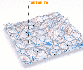 Places with similar names to Santa Rita, Guatemala ::
// Santa Rita (BR)
// Santa Rita (BR)
// Santa Rita (BR)
// Santa Rita (BR)
// Santa Rita (BR)
// Santa Rita (BR)
// Santa Rita (BR)
// Santa Rita (BR)
// Santa Rita (BR)
// Santa Rita (BR)
Disclaimer :: Information on this page comes without warranty of any kind |
||
|
Where is Santa Rita? Elevation and coordinates ::
Latitude (lat): 14°28'0"N Longitude (lon): 89°46'0"W
Elevation (approx.): 962m (map arrows pan, magnifying glasses zoom) |
||
|
Visiting Santa Rita? Hotel/Accommodation ::
Book a hotel in Santa Rita Travel Guide ::
Buy a travel guide for Guatemala rental cars ::
car rental offers GPS waypoint ::
download a GPX waypoint (PoI) of Santa Rita for your GPS receiver
|
||