|
search place name
|
||
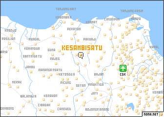
Kesambi Satu (Indonesia)Kesambi Satu is a town in Indonesia. An overview map of the region around Kesambi Satu is displayed below.
regional and 3d topo map of Kesambi Satu, Indonesia ::
Kesambi Satu airports ::
The nearest airport is CGK - Jakarta Soekarno Hatta Intl, located 9.7 km east of Kesambi Satu.
Nearby towns ::
Sarakan Satu (1.5km south west) //
Gintung (1.5km north west) //
Sepatan (1.7km south east) //
Pisangan Lor (2.0km north east) //
Bugel (2.9km south) //
Buaran (3.5km east) //
Jati (3.5km north west) //
Pakuaji (3.8km north east) //
Kedawang Kulon (4.1km south east) //
Rawakidang (4.3km north) //
Kola (4.2km east) //
Rawagempol (4.4km east) //
Jungkal (4.4km west) //
Bubulakbug (4.8km south) //
Pekajan (5.1km north west) //
Gaga (5.3km east) //
Tanjakan (5.5km west) //
Ketos Dua (5.7km south west) //
Kedawung-wetan (5.7km south east) //
Pekayon (5.9km north) //
Rajeg (6.0km west) //
Bajar (6.3km south east) //
Nagrak (6.3km south east) //
Putat (6.5km south west) //
Banununggul (6.6km south west) //
Guna (6.7km west) //
Tegalkunir Lot (7.2km north west) //
Selapajang (7.2km east) //
Panggang (7.2km south) //
[all distances 'as the bird flies' and approximate] 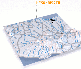 Places with similar names to Kesambi Satu, Indonesia ::
// Casa Mezzata (IT)
// Casa Mussota (IT)
// Cosîmbeşti (RO)
// Cosmeşti (RO)
// Cosmeşti (RO)
// Cozmeşti (RO)
// Cozmeşti (RO)
// Cozmeşti (RO)
// Cozmeşti (RO)
// Cozmeşti (RO)
Disclaimer :: Information on this page comes without warranty of any kind |
||
|
Where is Kesambi Satu? Elevation and coordinates ::
Latitude (lat): 6°6'18"S Longitude (lon): 106°34'15"E
Elevation (approx.): 8m (map arrows pan, magnifying glasses zoom) |
||
|
Visiting Kesambi Satu? Hotel/Accommodation ::
Book a hotel in Kesambi Satu Travel Guide ::
Buy a travel guide for Indonesia rental cars ::
car rental offers GPS waypoint ::
download a GPX waypoint (PoI) of Kesambi Satu for your GPS receiver
|
||