|
search place name
|
||
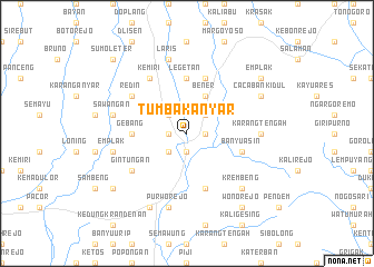
Tumbakanyar (Indonesia)Tumbakanyar is a town in Indonesia. An overview map of the region around Tumbakanyar is displayed below.
regional and 3d topo map of Tumbakanyar, Indonesia ::
Nearby towns ::
Wonotopo (1.8km west) //
Maron (1.9km south) //
Solotiang (1.8km east) //
Loano (2.6km south west) //
Crongeh (2.6km north west) //
Kaliboto (2.6km north east) //
Bener (4.1km north east) //
Gebang (5.5km west) //
Legetan (5.6km north) //
Wirosaran (5.9km south) //
Kalijambe (5.9km north) //
Banyuasin (5.8km east) //
Gintungan (6.6km south west) //
Kemiri (6.7km north west) //
Redin (6.6km north west) //
Karangtengah (7.3km east) //
Emplak (7.6km west) //
Emplak (7.6km west) //
Sawangan (7.6km west) //
Cangkrep (7.6km south) //
Purworejo (7.6km south) //
Laris (7.6km north) //
Krembeng (7.8km south east) //
Pangenjurutengah (8.3km south west) //
Cacabankidul (8.2km north east) //
Juruntengah (9.2km south west) //
Sucen (9.2km south west) //
Emplak (9.2km north east) //
Wonorejo (9.2km south east) //
[all distances 'as the bird flies' and approximate]  Places with similar names to Tumbakanyar, Indonesia :: Disclaimer :: Information on this page comes without warranty of any kind |
||
|
Where is Tumbakanyar? Elevation and coordinates ::
Latitude (lat): 7°39'0"S Longitude (lon): 110°2'0"E
Elevation (approx.): 119m (map arrows pan, magnifying glasses zoom) |
||
|
Visiting Tumbakanyar? Hotel/Accommodation ::
Book a hotel in Tumbakanyar Travel Guide ::
Buy a travel guide for Indonesia rental cars ::
car rental offers GPS waypoint ::
download a GPX waypoint (PoI) of Tumbakanyar for your GPS receiver
|
||