|
search place name
|
||
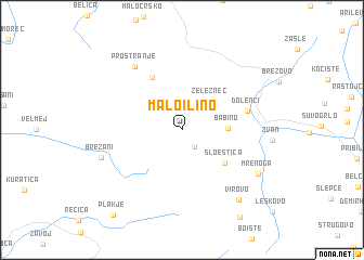
Malo Ilino (Macedonia, The Republic of)Malo Ilino is a town in Macedonia, The Republic of. An overview map of the region around Malo Ilino is displayed below.
regional and 3d topo map of Malo Ilino, Macedonia, The Republic of ::
Malo Ilino airports ::
The nearest airport is OHD - Ohrid, located 27.9 km south west of Malo Ilino.
Other airports nearby include SKP - Skopje (88.4 km north east), KSO - Kastoria Aristotelis (96.8 km south), TIA - Tirana Rinas (110.9 km west), KZI - Kozani Filippos (131.2 km south east), Nearby towns ::
Bazernik (1.9km south east) //
Golemo Ilino (3.2km north west) //
Železnec (3.7km north east) //
Babino (3.6km east) //
Sloeštica (4.8km south east) //
Velmevci (5.9km north west) //
Dolenci (5.4km east) //
Prostranje (7.5km north west) //
Brežani (6.9km south west) //
Mrenoga (7.4km south east) //
Virovo (8.5km south east) //
Plakje (10.3km south west) //
[all distances 'as the bird flies' and approximate] 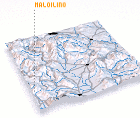 Places with similar names to Malo Ilino, Macedonia, The Republic of ::
Disclaimer :: Information on this page comes without warranty of any kind |
||
|
Where is Malo Ilino? Elevation and coordinates ::
Latitude (lat): 41°17'51"N Longitude (lon): 21°2'13"E
Elevation (approx.): 925m (map arrows pan, magnifying glasses zoom) |
||
|
Visiting Malo Ilino? Hotel/Accommodation ::
Book a hotel in Malo Ilino Travel Guide ::
rental cars ::
car rental offers GPS waypoint ::
download a GPX waypoint (PoI) of Malo Ilino for your GPS receiver
|
||