|
search place name
|
||
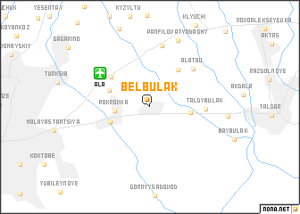
Bel'bulak (Almatinskaya Oblastʼ, Kazakhstan)Bel'bulak is a town in the Almatinskaya Oblastʼ region of Kazakhstan. An overview map of the region around Bel'bulak is displayed below.
regional and 3d topo map of Bel'bulak, Kazakhstan ::
Bel'bulak airports ::
The nearest airport is ALA - Alma-ata Almaty, located 6.1 km north west of Bel'bulak.
Nearby towns ::
Pokrovka (3.2km west) //
Pokrovka (3.2km west) //
Birlik (3.8km east) //
Birlik (3.8km east) //
Dzerzhinskoye (4.1km south west) //
Dzerzhīnskoe (4.1km south west) //
Otegen Batyr (4.3km north west) //
Tuzusay (5.3km north east) //
Krasnoye Pole (5.1km north west) //
Taldybulak (5.1km east) //
Alatau (6.2km north east) //
Alataū (6.2km north east) //
(( Bayserka )) (7.8km north) //
Imeni Panfilova (8.8km north) //
Panfīlov Atyndaghy (8.8km north) //
[all distances 'as the bird flies' and approximate] 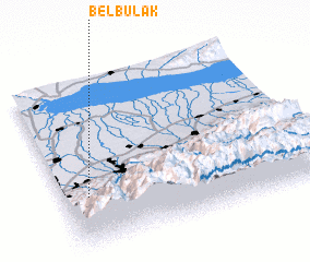 Places with similar names to Bel'bulak, Kazakhstan ::
// Bell Block (NZ)
// Bolbolak (IR)
// Bilbalgo (BF)
// Bilbalogo (BF)
// Bilbalogo (BF)
// Bilbalogo (BF)
// Bilibalogo (BF)
// Bul Bulak (PK)
// Bālā Bolūk (AF)
// Buulo Obliko (SO)
Disclaimer :: Information on this page comes without warranty of any kind |
||
|
Where is Bel'bulak? Elevation and coordinates ::
Latitude (lat): 43°18'52"N Longitude (lon): 77°5'45"E
Elevation (approx.): 765m (map arrows pan, magnifying glasses zoom) |
||
|
Visiting Bel'bulak? Hotel/Accommodation ::
Book a hotel in Bel'bulak Travel Guide ::
Buy a travel guide for Kazakhstan rental cars ::
car rental offers GPS waypoint ::
download a GPX waypoint (PoI) of Bel'bulak for your GPS receiver
|
||