|
search place name
|
||
Mankawnahugono (Ghana)Mankawnahugono is a town in Ghana. An overview map of the region around Mankawnahugono is displayed below.
regional and 3d topo map of Mankawnahugono, Ghana ::

Mankawnahugono airports ::
The nearest airport is NYI - Sunyani, located 96.9 km north west of Mankawnahugono.
Other airports nearby include ACC - Accra Kotoka Intl (212.3 km south east), Nearby towns ::
Duaponkaw (1.9km north) //
Hiaminkwa (2.6km south west) //
Mpentembua (2.6km north west) //
Asumjwi (2.6km north west) //
Montosua (4.1km north east) //
Dumechino (4.1km south east) //
Kwamang (4.1km south west) //
Domiabra (5.2km north east) //
Amoaku (5.2km north west) //
Boamang (5.2km north west) //
Oyira (5.5km east) //
Kokosachi (5.5km west) //
Wawasi (5.6km south) //
Mpobi (5.9km south) //
Kankamkrom (5.9km north) //
Nsutem (5.8km west) //
Ahinkro (5.8km west) //
Datano (5.8km east) //
Nyamisenade (5.8km east) //
Muawso (6.7km north east) //
Asenyebun (6.6km south east) //
Ankasi (6.7km south east) //
Daboya (6.7km south east) //
Masi (6.7km north west) //
Odumase (7.4km east) //
Ofinso (7.4km west) //
Dikan (7.6km east) //
Ehiaminchini (7.6km north) //
Nkewu (7.6km west) //
[all distances 'as the bird flies' and approximate] 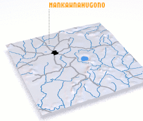 Places with similar names to Mankawnahugono, Ghana :: Disclaimer :: Information on this page comes without warranty of any kind |
||
|
Where is Mankawnahugono? Elevation and coordinates ::
Latitude (lat): 6°54'0"N Longitude (lon): 1°35'0"W
Elevation (approx.): 269m (map arrows pan, magnifying glasses zoom) |
||
|
Visiting Mankawnahugono? Hotel/Accommodation ::
Book a hotel in Mankawnahugono Travel Guide ::
Buy a travel guide for Ghana rental cars ::
car rental offers GPS waypoint ::
download a GPX waypoint (PoI) of Mankawnahugono for your GPS receiver
|
||