|
search place name
|
||
Álvaro Díaz (Veracruz-Llave, Mexico)Álvaro Díaz is a town in the Veracruz-Llave region of Mexico. An overview map of the region around Álvaro Díaz is displayed below.
regional and 3d topo map of Álvaro Díaz, Mexico ::

Álvaro Díaz airports ::
The nearest airport is MTT - Minatitlan, located 62.7 km north east of Álvaro Díaz.
Other airports nearby include OAX - Oaxaca Xoxocotlan Intl (207.5 km west), VER - Vera Cruz General Heriberto Jara Intl (218.3 km north west), TGZ - Tuxtla Gutierrez Angel Albino Corzo (229.6 km south east), HUX - Bahias Dehuatulco Bahias De Huatulco Intl (251.3 km south west), Nearby towns ::
Monte Obscuro (2.6km north west) //
Angustias (6.5km north east) //
La Encantada (10.2km north east) //
[all distances 'as the bird flies' and approximate] 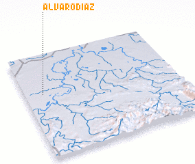 Places with similar names to Álvaro Díaz, Mexico ::
// Alvaredos (PT)
// Al Furaydīs (LB)
// Alfords (US)
// Al Firdaws (IQ)
// Al Firdaws (SY)
// Alfords (US)
// Alvarados (MX)
Disclaimer :: Information on this page comes without warranty of any kind |
||
|
Where is Álvaro Díaz? Elevation and coordinates ::
Latitude (lat): 17°37'0"N Longitude (lon): 94°53'0"W
Elevation (approx.): 36m (map arrows pan, magnifying glasses zoom) |
||
|
Visiting Álvaro Díaz? Hotel/Accommodation ::
Book a hotel in Álvaro Díaz Travel Guide ::
Buy a travel guide for Mexico rental cars ::
car rental offers GPS waypoint ::
download a GPX waypoint (PoI) of Álvaro Díaz for your GPS receiver
|
||