|
search place name
|
||
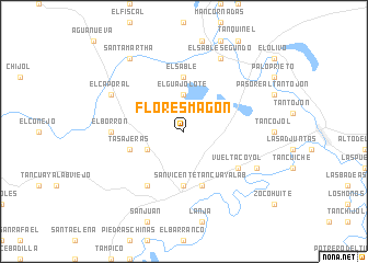
Flores Magón (San Luis Potosí, Mexico)Flores Magón is a town in the San Luis Potosí region of Mexico. An overview map of the region around Flores Magón is displayed below.
regional and 3d topo map of Flores Magón, Mexico ::
Flores Magón airports ::
The nearest airport is TSL - Tamuin, located 36.5 km north west of Flores Magón.
Other airports nearby include TAM - Tampico General Francisco Javier Mina Intl (93.3 km north east), PAZ - Poza Rico Tajin (175.1 km south east), PCA - Pachuca Ingeniero Juan Guillermo Villasana (190.0 km south), QRO - Queretaro Intercontinental (210.6 km south west), Nearby towns ::
El Guajolote (3.7km north) //
Miralomas (3.9km south west) //
El Ciruelo (5.6km south) //
El Sable (5.6km north) //
Tasajeras (5.5km west) //
San Vicente Tancuayalab (5.8km south) //
El Sabino (6.4km south east) //
Vuelta Coyol (6.4km south east) //
La Tima (6.5km south west) //
El Borrón (6.9km west) //
El Sasub (7.8km south east) //
El Sable Segundo (8.2km north east) //
El Caporal (7.8km north west) //
Santa Martha (9.0km north west) //
[all distances 'as the bird flies' and approximate] 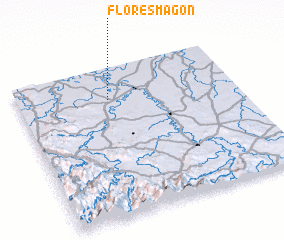 Places with similar names to Flores Magón, Mexico ::
// Flores Magón (MX)
// Flores Magón (MX)
// Flores Magón (MX)
// Flores Magón (MX)
// Flores Magón (MX)
Disclaimer :: Information on this page comes without warranty of any kind |
||
|
Where is Flores Magón? Elevation and coordinates ::
Latitude (lat): 21°47'0"N Longitude (lon): 98°35'0"W
Elevation (approx.): 40m (map arrows pan, magnifying glasses zoom) |
||
|
Visiting Flores Magón? Hotel/Accommodation ::
Book a hotel in Flores Magón Travel Guide ::
Buy a travel guide for Mexico rental cars ::
car rental offers GPS waypoint ::
download a GPX waypoint (PoI) of Flores Magón for your GPS receiver
|
||