|
search place name
|
||
La Arboleda (México, Mexico)La Arboleda is a town in the México region of Mexico. An overview map of the region around La Arboleda is displayed below.
regional and 3d topo map of La Arboleda, Mexico ::

La Arboleda airports ::
The nearest airport is MLM - Morelia General Francisco J Mujica Intl, located 116.2 km north west of La Arboleda.
Other airports nearby include TLC - Toluca Licenciado Adolfo Lopez Mateos Intl (117.1 km north east), CVJ - Cuernavaca General Mariano Matamoros (138.6 km east), UPN - Uruapan Licenciado Y Gen Ignacio Lopez Rayon (163.9 km west), MEX - Mexico City Licenciado Benito Juarez Intl (169.2 km east), Nearby towns ::
Playa El Guayabo (1.3km north west) //
Las Anonas (1.9km north) //
Chongupo (2.1km north east) //
Ojo de Agua (2.1km south east) //
Palo Gordo (2.8km south) //
Mesa de Nietos (2.8km east) //
La Camelina (3.8km north) //
La Congrega (3.8km south east) //
El Limón (4.3km north) //
Los Arrayanes (4.5km south east) //
El Pinzán (4.5km south east) //
Los Llanitos (4.8km south east) //
Lampazos (6.1km west) //
La Sanguijuela (6.1km east) //
El Terrero (6.5km north) //
Paso Tierra Caliente (6.4km north east) //
El Carrizal (7.2km north east) //
El Pollilo (7.4km north east) //
Avellaneda (8.2km north east) //
Palos Verdes (8.4km north east) //
La Mesa del Potrero Chiquito (8.1km east) //
La Laguna (8.1km east) //
El Sauz (8.1km east) //
Los Cuajilotes (9.4km north east) //
El Cascalote (9.5km north east) //
Las Ceibas de Trujillo (10.5km north west) //
[all distances 'as the bird flies' and approximate] 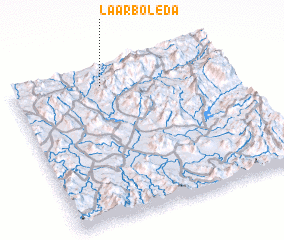 Places with similar names to La Arboleda, Mexico ::
// La Arboleda (CU)
// La Arboleda (CU)
// La Rebollada (ES)
// La Rebollada (ES)
// La Rebollada (ES)
// La Rebolleda (ES)
// La Arrobleda (CO)
// La Arboleda (VE)
// La Rebollada (ES)
// La Arboleda (ES)
Disclaimer :: Information on this page comes without warranty of any kind |
||
|
Where is La Arboleda? Elevation and coordinates ::
Latitude (lat): 18°53'30"N Longitude (lon): 100°34'30"W
Elevation (approx.): 496m (map arrows pan, magnifying glasses zoom) |
||
|
Visiting La Arboleda? Hotel/Accommodation ::
Book a hotel in La Arboleda Travel Guide ::
Buy a travel guide for Mexico rental cars ::
car rental offers GPS waypoint ::
download a GPX waypoint (PoI) of La Arboleda for your GPS receiver
|
||