|
search place name
|
||
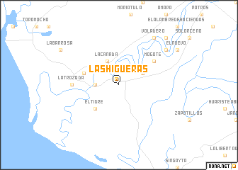
Las Higueras (Nayarit, Mexico)Las Higueras is a town in the Nayarit region of Mexico. An overview map of the region around Las Higueras is displayed below.
regional and 3d topo map of Las Higueras, Mexico ::
Las Higueras airports ::
The nearest airport is TPQ - Tepic, located 58.6 km south east of Las Higueras.
Other airports nearby include PVR - Puerto Vallarta Licenciado Gustavo Diaz Ordaz Intl (111.4 km south), MZT - Mazatlan General Rafael Buelna Intl (189.8 km north west), Nearby towns ::
Playa de Ramírez (3.4km west) //
La Culebra (3.9km north east) //
Aután (3.9km north east) //
La Cañada (4.1km north west) //
El Tigre (5.1km south west) //
El Pozole (5.5km west) //
Mogote (6.4km north east) //
La Trozada (6.9km west) //
Corte (8.9km north east) //
Voladero (9.0km north east) //
El Patroneño (10.1km north east) //
[all distances 'as the bird flies' and approximate] 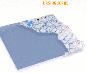 Places with similar names to Las Higueras, Mexico ::
// Las Higueras (ES)
// Las Higueras (ES)
// Las Higueras (CL)
// Las Higueras (SV)
// Las Higueras (SV)
// Las Higueras (MX)
// Las Higueras (MX)
// Las Higueras (MX)
// Las Higueras (MX)
// Las Higueras (MX)
Disclaimer :: Information on this page comes without warranty of any kind |
||
|
Where is Las Higueras? Elevation and coordinates ::
Latitude (lat): 21°41'0"N Longitude (lon): 105°20'0"W
Elevation (approx.): 6m (map arrows pan, magnifying glasses zoom) |
||
|
Visiting Las Higueras? Hotel/Accommodation ::
Book a hotel in Las Higueras Travel Guide ::
Buy a travel guide for Mexico rental cars ::
car rental offers GPS waypoint ::
download a GPX waypoint (PoI) of Las Higueras for your GPS receiver
|
||