|
search place name
|
||
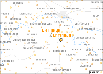
La Tinaja (Guanajuato, Mexico)La Tinaja is a town in the Guanajuato region of Mexico. An overview map of the region around La Tinaja is displayed below.
regional and 3d topo map of La Tinaja, Mexico ::
La Tinaja airports ::
The nearest airport is BJX - Del Bajio Guanajuato Intl, located 60.3 km north west of La Tinaja.
Other airports nearby include MLM - Morelia General Francisco J Mujica Intl (75.3 km south), QRO - Queretaro Intercontinental (110.1 km east), ZMM - Zamora (120.0 km south west), UPN - Uruapan Licenciado Y Gen Ignacio Lopez Rayon (148.5 km south west), Nearby towns ::
Santo Domingo (1.8km north) //
San Joaquín (2.6km south west) //
La Cal (2.5km north east) //
Labor de Valtierra (2.5km south west) //
El Refugio (3.5km north east) //
San Manuel (3.9km south west) //
La Labor de Valtierra (4.1km south west) //
Palo Blanco (4.0km north east) //
San Nicolás (4.1km south east) //
La Tinaja (4.1km south east) //
Puerto de Guadalupe (5.0km north west) //
Palma (5.1km south) //
San Isidro (5.2km north east) //
Los Lobos (5.4km south east) //
Uruétaro (5.6km east) //
El Cuatro de Altamira (5.6km east) //
Santiaguillo de García (6.4km north west) //
La Paz (6.4km north east) //
Rancho Seco (6.8km south east) //
El Tambor (6.5km west) //
Magdalena (7.1km north) //
San Juanito (7.3km north) //
San Juan (7.3km north) //
Sauz de Purísima (7.1km north west) //
Los Duros (7.4km north west) //
Luna (7.5km north) //
Los Patios (7.2km south west) //
Manga (7.2km east) //
Rivera de Guadalupe (7.4km east) //
[all distances 'as the bird flies' and approximate] 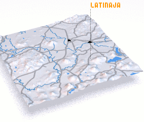 Places with similar names to La Tinaja, Mexico ::
Disclaimer :: Information on this page comes without warranty of any kind |
||
|
Where is La Tinaja? Elevation and coordinates ::
Latitude (lat): 20°30'3"N Longitude (lon): 101°14'3"W
Elevation (approx.): 1719m (map arrows pan, magnifying glasses zoom) |
||
|
Visiting La Tinaja? Hotel/Accommodation ::
Book a hotel in La Tinaja Travel Guide ::
Buy a travel guide for Mexico rental cars ::
car rental offers GPS waypoint ::
download a GPX waypoint (PoI) of La Tinaja for your GPS receiver
|
||