|
search place name
|
||
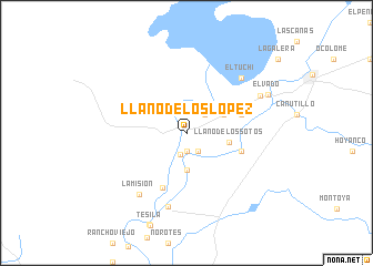
LLano de los López (Sinaloa, Mexico)LLano de los López is a town in the Sinaloa region of Mexico. An overview map of the region around LLano de los López is displayed below.
regional and 3d topo map of LLano de los López, Mexico ::
LLano de los López airports ::
The nearest airport is LMM - Los Mochis Valle Del Fuerte Intl, located 83.1 km south west of LLano de los López.
Other airports nearby include CEN - Ciudad Obregon Intl (157.7 km north west), CUL - Culiacan Intl (217.9 km south east), Nearby towns ::
Los Sotos (1.9km south) //
Los Terreros (2.1km south east) //
Zozorique (2.3km south) //
Arroyo de los Armenta (2.5km north east) //
Bajada del Monte (3.7km south) //
La Bomba (3.8km north east) //
Llano de los Sotos (3.9km east) //
El Altillo (5.3km east) //
Vivajaqui (5.3km east) //
Boca del Arroyo (5.9km south) //
Boca de Alfayo (7.6km south) //
La Misión (7.4km south west) //
El Tuchi (7.5km north east) //
Barotén (7.6km north east) //
El Vado (8.3km north east) //
[all distances 'as the bird flies' and approximate] 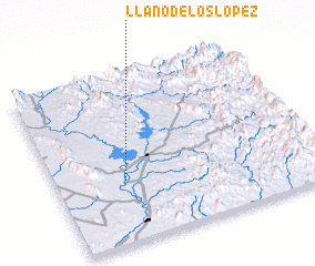 Places with similar names to LLano de los López, Mexico :: Disclaimer :: Information on this page comes without warranty of any kind |
||
|
Where is LLano de los López? Elevation and coordinates ::
Latitude (lat): 26°22'0"N Longitude (lon): 108°44'0"W
Elevation (approx.): 69m (map arrows pan, magnifying glasses zoom) |
||
|
Visiting LLano de los López? Hotel/Accommodation ::
Book a hotel in LLano de los López Travel Guide ::
Buy a travel guide for Mexico rental cars ::
car rental offers GPS waypoint ::
download a GPX waypoint (PoI) of LLano de los López for your GPS receiver
|
||