|
search place name
|
||
Peñas Cuatas (México, Mexico)Peñas Cuatas is a town in the México region of Mexico. An overview map of the region around Peñas Cuatas is displayed below.
regional and 3d topo map of Peñas Cuatas, Mexico ::

Peñas Cuatas airports ::
The nearest airport is TLC - Toluca Licenciado Adolfo Lopez Mateos Intl, located 16.7 km south west of Peñas Cuatas.
Other airports nearby include MEX - Mexico City Licenciado Benito Juarez Intl (38.3 km east), CVJ - Cuernavaca General Mariano Matamoros (67.9 km south), PCA - Pachuca Ingeniero Juan Guillermo Villasana (99.5 km north east), PBC - Puebla Hermanos Serdan Intl (115.8 km east), Nearby towns ::
Las Rajas (2.4km east) //
Tejocotillos (2.5km west) //
Peñas Cuatas (3.1km north west) //
San Augustín Huitzitzilapan (3.1km west) //
San Lorenzo Huitzitzilapan (3.7km south west) //
Sacamulpa Huitzitzilapan (3.9km south west) //
San Miguel Mimiapan (4.0km north west) //
Sacamulpa Tlamimilolpan (4.3km south) //
Huitzizilapan (4.2km south west) //
Xochicuautla (4.7km south) //
Huixquilucan de Degollado (4.9km south) //
Rancho Viejo (5.4km south) //
Santa María Tlamimilolpan (5.4km south west) //
Allende (5.6km north west) //
Villa Alpina (5.4km east) //
El Guarda (5.8km east) //
Zolotepec (6.1km west) //
San Francisco Xochicuaulta (6.6km south) //
Santa Ana Jilotzingo (6.4km north west) //
El Guarda (6.5km east) //
Dolores (6.6km south west) //
Santa Catarina (6.9km south west) //
Santa Cruz Ayotusco (7.9km south east) //
La Huanica (8.2km north west) //
Álvaro Obregón (8.3km south west) //
Llano Grande (8.5km south east) //
San Nicolás Peralta (9.0km south west) //
Barrio Las Manzanas (9.3km north east) //
Barrio Las Manzanas (9.6km north east) //
[all distances 'as the bird flies' and approximate] 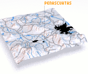 Places with similar names to Peñas Cuatas, Mexico ::
// Peñas Chatas (PA)
// Peñas Cuatas (MX)
// Peñasquitos (MX)
// Peñasquitos (MX)
// Pinos Cuates (MX)
// Pinos Caídos (HN)
Disclaimer :: Information on this page comes without warranty of any kind |
||
|
Where is Peñas Cuatas? Elevation and coordinates ::
Latitude (lat): 19°25'31"N Longitude (lon): 99°26'12"W
Elevation (approx.): 2930m (map arrows pan, magnifying glasses zoom) |
||
|
Visiting Peñas Cuatas? Hotel/Accommodation ::
Book a hotel in Peñas Cuatas Travel Guide ::
Buy a travel guide for Mexico rental cars ::
car rental offers GPS waypoint ::
download a GPX waypoint (PoI) of Peñas Cuatas for your GPS receiver
|
||