|
search place name
|
||
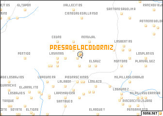
Presa de la Codorniz (Aguascalientes, Mexico)Presa de la Codorniz is a town in the Aguascalientes region of Mexico. An overview map of the region around Presa de la Codorniz is displayed below.
regional and 3d topo map of Presa de la Codorniz, Mexico ::
Presa de la Codorniz airports ::
The nearest airport is AGU - Aguascalientes Jesus Teran Intl, located 49.9 km south east of Presa de la Codorniz.
Other airports nearby include ZCL - Zacatecas General Leobardo C Ruiz Intl (97.5 km north), BJX - Del Bajio Guanajuato Intl (167.1 km south east), GDL - Guadalajara Don Miguel Hidalgo Y Costilla Intl (178.5 km south), SLP - San Luis Potosi Ponciano Arriaga Intl (181.0 km east), Nearby towns ::
Las Rubias (0.9km west) //
Terrero de la Labor (1.9km north) //
Puerta de Fragua (1.9km south) //
Manzano (2.5km north west) //
Las Cuevas (2.5km south east) //
Ciénega de Gallardo (3.4km west) //
El Sauz (3.5km south east) //
Palo Alto (4.1km north west) //
Rendijal (4.1km north east) //
El Jagúey (5.6km south) //
Las Minas (5.2km west) //
El Zapote (5.6km south) //
Piedras Chinas (5.6km south) //
La Boquilla (5.2km west) //
La Ordeña (5.5km west) //
Cedro (6.3km north west) //
El Temascal (6.7km west) //
Los Lazo (7.1km south east) //
La Labor (7.3km south west) //
Carboneras (7.1km west) //
Gallinas (7.1km east) //
Los Guajes (7.6km south) //
El Banco de Carbón (8.1km south) //
Ojo de Agua de los Negros (8.4km south) //
El Llanito (8.3km south) //
Manguillas (8.8km south west) //
El Capulín (8.8km south east) //
La Pedrera (9.2km south west) //
Saltillo (11.2km south west) //
[all distances 'as the bird flies' and approximate] 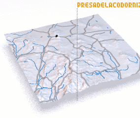 Places with similar names to Presa de la Codorniz, Mexico :: Disclaimer :: Information on this page comes without warranty of any kind |
||
|
Where is Presa de la Codorniz? Elevation and coordinates ::
Latitude (lat): 22°1'0"N Longitude (lon): 102°40'0"W
Elevation (approx.): 2024m (map arrows pan, magnifying glasses zoom) |
||
|
Visiting Presa de la Codorniz? Hotel/Accommodation ::
Book a hotel in Presa de la Codorniz Travel Guide ::
Buy a travel guide for Mexico rental cars ::
car rental offers GPS waypoint ::
download a GPX waypoint (PoI) of Presa de la Codorniz for your GPS receiver
|
||