|
search place name
|
||
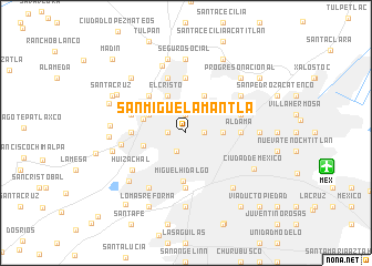
San Miguel Amantla (Distrito Federal, Mexico)San Miguel Amantla is a town in the Distrito Federal region of Mexico. An overview map of the region around San Miguel Amantla is displayed below.
regional and 3d topo map of San Miguel Amantla, Mexico ::
San Miguel Amantla airports ::
The nearest airport is MEX - Mexico City Licenciado Benito Juarez Intl, located 13.8 km east of San Miguel Amantla.
Other airports nearby include TLC - Toluca Licenciado Adolfo Lopez Mateos Intl (41.0 km west), CVJ - Cuernavaca General Mariano Matamoros (70.2 km south), PCA - Pachuca Ingeniero Juan Guillermo Villasana (80.5 km north east), PBC - Puebla Hermanos Serdan Intl (93.5 km east), Nearby towns ::
Santa Cruz Acayucan (1.9km north) //
La Preciosa (1.9km north) //
La Petrolera (1.9km north) //
San Álvaro (1.7km east) //
Ahuixotla Prolongación (1.7km west) //
Huizachal (2.0km south west) //
Azcapotzalco (3.0km north east) //
Tlatilco (3.5km east) //
Cosmopolita (3.5km east) //
Obrero Popular (3.5km east) //
El Gas (3.5km east) //
Nueva Santa María (3.5km east) //
Santa Cruz Acatlán (4.0km north west) //
El Cristo (4.1km north west) //
Reinosa Tamaulipas (4.1km north east) //
Naucalpan de Juárez (4.3km west) //
San Antonio Zomeyucan (4.3km west) //
Miguel Hidalgo (4.9km south) //
La Florida (5.1km north west) //
Aguilera (5.2km east) //
Patrimonio (5.2km east) //
Aldama (5.2km east) //
Loma Colorado (5.2km west) //
San Jerónimo Tepetlacalco (5.6km north) //
El Arenal (5.2km east) //
Polanco (5.6km south) //
San Mateo Nopala (5.6km west) //
Magdalena de las Salinas (5.6km east) //
Defensores de la República (5.6km east) //
[all distances 'as the bird flies' and approximate]  Places with similar names to San Miguel Amantla, Mexico :: Disclaimer :: Information on this page comes without warranty of any kind |
||
|
Where is San Miguel Amantla? Elevation and coordinates ::
Latitude (lat): 19°28'0"N Longitude (lon): 99°12'0"W
Elevation (approx.): 2255m (map arrows pan, magnifying glasses zoom) |
||
|
Visiting San Miguel Amantla? Hotel/Accommodation ::
Book a hotel in San Miguel Amantla Travel Guide ::
Buy a travel guide for Mexico rental cars ::
car rental offers GPS waypoint ::
download a GPX waypoint (PoI) of San Miguel Amantla for your GPS receiver
|
||