|
search place name
|
||
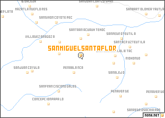
San Miguel Santa Flor (Oaxaca, Mexico)San Miguel Santa Flor is a town in the Oaxaca region of Mexico. An overview map of the region around San Miguel Santa Flor is displayed below.
regional and 3d topo map of San Miguel Santa Flor, Mexico ::
San Miguel Santa Flor airports ::
The nearest airport is TCN - Tehuacan, located 90.1 km north west of San Miguel Santa Flor.
Other airports nearby include OAX - Oaxaca Xoxocotlan Intl (104.5 km south), VER - Vera Cruz General Heriberto Jara Intl (148.0 km north east), PBC - Puebla Hermanos Serdan Intl (213.9 km north west), TXA - Tlaxcala (228.7 km north west), Nearby towns ::
Peña Blanca (3.5km south west) //
Chiquihuitlán de Benito Juárez (4.6km north) //
Cuyamecalco Villa de Zaragoza (4.8km north west) //
Buenos Aires (5.2km west) //
Santa Ana Cuauhtémoc (5.7km north) //
Buenos Aires (6.3km north west) //
San Francisco Chapulapa (6.8km east) //
Santa María Tlalixtac (7.1km east) //
San Alejo (8.6km south east) //
San Francisco Nogales (8.9km south west) //
San Pedro Teutila (9.6km north east) //
San Simón Coyotepec (10.1km north west) //
Peña Verde (11.7km south east) //
[all distances 'as the bird flies' and approximate] 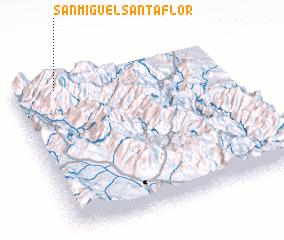 Places with similar names to San Miguel Santa Flor, Mexico :: Disclaimer :: Information on this page comes without warranty of any kind |
||
|
Where is San Miguel Santa Flor? Elevation and coordinates ::
Latitude (lat): 17°56'30"N Longitude (lon): 96°47'48"W
Elevation (approx.): 1710m (map arrows pan, magnifying glasses zoom) |
||
|
Visiting San Miguel Santa Flor? Hotel/Accommodation ::
Book a hotel in San Miguel Santa Flor Travel Guide ::
Buy a travel guide for Mexico rental cars ::
car rental offers GPS waypoint ::
download a GPX waypoint (PoI) of San Miguel Santa Flor for your GPS receiver
|
||