|
search place name
|
||
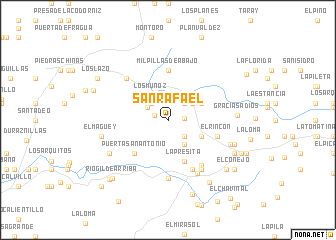
San Rafael (Aguascalientes, Mexico)San Rafael is a town in the Aguascalientes region of Mexico. An overview map of the region around San Rafael is displayed below.
regional and 3d topo map of San Rafael, Mexico ::
San Rafael airports ::
The nearest airport is AGU - Aguascalientes Jesus Teran Intl, located 34.8 km south east of San Rafael.
Other airports nearby include ZCL - Zacatecas General Leobardo C Ruiz Intl (109.3 km north), BJX - Del Bajio Guanajuato Intl (152.0 km south east), GDL - Guadalajara Don Miguel Hidalgo Y Costilla Intl (172.7 km south west), SLP - San Luis Potosi Ponciano Arriaga Intl (172.9 km east), Nearby towns ::
Buenos Aires (1.5km west) //
Rinconcito Lejano (1.7km east) //
La Mesita de Piedra (2.5km north west) //
Corral Colorado (2.5km north east) //
Pensamiento (2.5km south east) //
Vallecitos (2.6km north west) //
Los Muñoz (3.3km north west) //
Los Ponce (3.2km north east) //
El Contadero (3.3km south east) //
Milpillas de Arriba (3.9km north east) //
El Pedernal (3.9km south east) //
La Presita (4.9km south) //
Puerta San Antonio (5.1km south west) //
Milpillas de Abajo (5.6km north) //
El Rincón (5.5km east) //
Las Amarillas (6.1km south east) //
La Fortuna (6.1km south east) //
Los Puentes Cuates (6.5km south) //
El Capulín (6.3km north west) //
Tapias Viejas (6.5km south east) //
La Boquilla (6.7km south east) //
El Sauz (7.1km south west) //
Puerta Los Toros (7.0km south east) //
El Maguey (7.1km west) //
Gracias a Dios (7.2km east) //
Pedernal (7.4km east) //
San José del Llano (7.8km south east) //
El Puente (8.2km south east) //
Piedras Negras (8.2km south east) //
[all distances 'as the bird flies' and approximate] 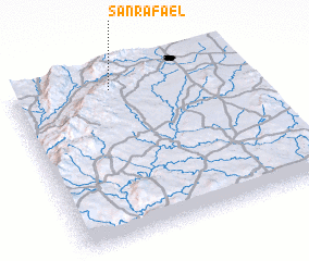 Places with similar names to San Rafael, Mexico ::
// San Rafael (US)
// San Rafael (US)
// Sonoraville (US)
// San Rafael (PA)
// San Rafael (PA)
// San Ruffillo (IT)
// San Rafael (CU)
// San Rafael (CU)
// San Rafael (CU)
// San Rafael (CU)
Disclaimer :: Information on this page comes without warranty of any kind |
||
|
Where is San Rafael? Elevation and coordinates ::
Latitude (lat): 21°55'0"N Longitude (lon): 102°34'0"W
Elevation (approx.): 2208m (map arrows pan, magnifying glasses zoom) |
||
|
Visiting San Rafael? Hotel/Accommodation ::
Book a hotel in San Rafael Travel Guide ::
Buy a travel guide for Mexico rental cars ::
car rental offers GPS waypoint ::
download a GPX waypoint (PoI) of San Rafael for your GPS receiver
|
||