|
search place name
|
||
Santa Inés Tecuexcomac (Tlaxcala, Mexico)Santa Inés Tecuexcomac is a town in the Tlaxcala region of Mexico. An overview map of the region around Santa Inés Tecuexcomac is displayed below.
regional and 3d topo map of Santa Inés Tecuexcomac, Mexico ::

Santa Inés Tecuexcomac airports ::
The nearest airport is PBC - Puebla Hermanos Serdan Intl, located 14.4 km south of Santa Inés Tecuexcomac.
Other airports nearby include TXA - Tlaxcala (32.8 km north east), MEX - Mexico City Licenciado Benito Juarez Intl (79.4 km west), PCA - Pachuca Ingeniero Juan Guillermo Villasana (99.7 km north west), CVJ - Cuernavaca General Mariano Matamoros (109.6 km south west), Nearby towns ::
Xiloxochitla (1.7km east) //
Nopalucan (1.9km north) //
Tequixquitla (1.9km north) //
Luis Echeverría (2.5km east) //
La Soledad (3.4km north) //
Tezoquipan (4.2km north east) //
San Miguel del Milagro (4.8km south) //
Tecoac (5.1km north) //
San Diego Xocoyucan (4.9km north west) //
Santa Apolonia Teacalco (5.1km south east) //
Tenanyecac (5.1km south west) //
Tizostoc (5.4km north) //
Xochitecatitla (5.4km south west) //
Tepetitla (5.2km west) //
Teacalco (5.5km south east) //
Santa Cruz del Porvenir (5.6km north) //
Texoloc (5.4km east) //
Nativitas (5.8km south) //
Capula (5.9km south) //
Jesús Acatitla (5.8km north east) //
Techachalco (5.8km north east) //
Rojano (5.7km north west) //
Guadalupe Victoria (6.1km south) //
Tenango (6.0km south east) //
Tenexyecac (6.2km north) //
Aculco (6.0km east) //
San Mateo Ayecac (6.1km west) //
Xochimilco (6.5km north) //
La Concordia (6.6km south east) //
[all distances 'as the bird flies' and approximate] 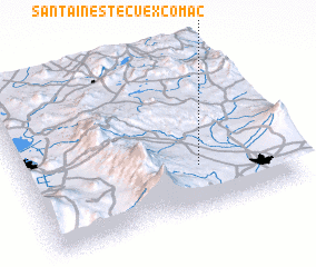 Places with similar names to Santa Inés Tecuexcomac, Mexico :: Disclaimer :: Information on this page comes without warranty of any kind |
||
|
Where is Santa Inés Tecuexcomac? Elevation and coordinates ::
Latitude (lat): 19°17'0"N Longitude (lon): 98°20'0"W
Elevation (approx.): 2212m (map arrows pan, magnifying glasses zoom) |
||
|
Visiting Santa Inés Tecuexcomac? Hotel/Accommodation ::
Book a hotel in Santa Inés Tecuexcomac Travel Guide ::
Buy a travel guide for Mexico rental cars ::
car rental offers GPS waypoint ::
download a GPX waypoint (PoI) of Santa Inés Tecuexcomac for your GPS receiver
|
||