|
search place name
|
||
Aïn Aakrîne (Liban-Nord, Lebanon)Aïn Aakrîne is a town in the Liban-Nord region of Lebanon. An overview map of the region around Aïn Aakrîne is displayed below.
regional and 3d topo map of Aïn Aakrîne, Lebanon ::

Aïn Aakrîne airports ::
The nearest airport is BEY - Beirut Rafic Hariri Intl, located 61.2 km south west of Aïn Aakrîne.
Other airports nearby include DAM - Damascus Intl (114.9 km south east), LTK - Latakia Bassel Al Assad Intl (124.2 km north), RPN - Rosh Pina Mahanaim I Ben Yaakov (146.9 km south), HFA - Haifa (179.9 km south west), Nearby towns ::
Nâous (0.7km north west) //
Bnahrâne (1.2km south) //
Rechdibbîne (1.3km north east) //
Koûsba (1.6km north) //
Kfar Sâroûn (1.7km north west) //
Bhabboûch (1.9km south west) //
Chîra (2.1km south east) //
Kfar Aaqqa (2.3km north west) //
Bnîta (2.4km north west) //
Beït Abou Ishâq (2.5km south east) //
Beït ech Chaâr (2.7km south) //
Metrît (2.8km south) //
Moghr el Ahoual (2.4km east) //
Bzîza (2.8km south west) //
Ard el Hsseïn (2.9km east) //
Râs Kîfa (3.3km north east) //
Krabraïbé (3.1km north east) //
Zgharta el Mtâoulé (3.7km south) //
Ḩayy Mār Anţūniyūs (3.9km south) //
Ḩayy Mār Taqlā (3.9km south) //
Mazra‘at Kassāb (3.9km south) //
Berhalioûn (3.7km south east) //
Chnâta (3.8km south west) //
Sarghoûn (3.6km west) //
Mazra‘at ‘Assāf (4.3km south east) //
Barḩalyūn (3.9km south east) //
Aabdîne (3.9km east) //
Deïr Billa (4.4km south west) //
Ouata Fârès (4.2km south west) //
[all distances 'as the bird flies' and approximate] 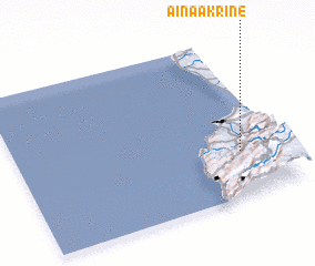 Places with similar names to Aïn Aakrîne, Lebanon ::
Disclaimer :: Information on this page comes without warranty of any kind |
||
|
Where is Aïn Aakrîne? Elevation and coordinates ::
Latitude (lat): 34°17'6"N Longitude (lon): 35°50'52"E
Elevation (approx.): 586m (map arrows pan, magnifying glasses zoom) |
||
|
Visiting Aïn Aakrîne? Hotel/Accommodation ::
Book a hotel in Aïn Aakrîne Travel Guide ::
Buy a travel guide for Lebanon rental cars ::
car rental offers GPS waypoint ::
download a GPX waypoint (PoI) of Aïn Aakrîne for your GPS receiver
|
||