|
search place name
|
||
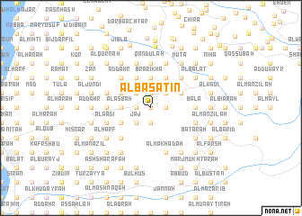
Al Basātīn (Mont-Liban, Lebanon)Al Basātīn is a town in the Mont-Liban region of Lebanon. An overview map of the region around Al Basātīn is displayed below.
regional and 3d topo map of Al Basātīn, Lebanon ::
Al Basātīn airports ::
The nearest airport is BEY - Beirut Rafic Hariri Intl, located 50.4 km south west of Al Basātīn.
Other airports nearby include DAM - Damascus Intl (107.3 km south east), RPN - Rosh Pina Mahanaim I Ben Yaakov (135.3 km south), LTK - Latakia Bassel Al Assad Intl (135.6 km north), HFA - Haifa (168.5 km south west), Nearby towns ::
Qabr as Sindiyān (0.0km north) //
Al Waţāʼ (0.0km north) //
Ḩārat Bū ‘Awwād (0.0km north) //
Tartij (1.5km east) //
Al Waţāʼ (1.9km south) //
Rām (1.5km west) //
Şulayyib Rām (1.5km west) //
Ḑahr al Ḩarf (1.9km north) //
Dayr al Qaţţārah (1.5km west) //
Al Ansīl (2.4km south west) //
Ḩārat at Taḩtā (2.4km north east) //
Jāj (2.4km south west) //
‘Ukfur (2.4km north east) //
Ḩārat al Wādī (2.4km north east) //
Şulayyib Bshi‘lah (2.4km north east) //
Douma (2.4km north east) //
Ḩārat al Fawqā (2.4km north east) //
Saqy Rishmayyā (2.4km south west) //
Bshi‘lahl (2.4km north east) //
Ḩadtūn (2.4km north west) //
Al Qaţţārah (3.1km west) //
Ar Ruʼays (3.7km north) //
Brārīkhā (3.7km north) //
Kafr Shillah (3.1km west) //
Bashtūdār (3.7km north) //
Al ‘Aşbah (3.1km west) //
Ḩārat ash Shamīs (3.1km west) //
Ghammās al Qaţţārah (3.1km west) //
Mayfūq (3.1km west) //
[all distances 'as the bird flies' and approximate]  Places with similar names to Al Basātīn, Lebanon ::
// Al Basātīn (EG)
// Al Basātīn (EG)
// Al Bustān (EG)
// Al Bustān (TN)
// Al Bustān (SA)
// Al Bustān (SY)
// Al Bustān (SY)
// Al Bustān (SY)
// Al Bustān (OM)
// Albouystown (GY)
Disclaimer :: Information on this page comes without warranty of any kind |
||
|
Where is Al Basātīn? Elevation and coordinates ::
Latitude (lat): 34°11'0"N Longitude (lon): 35°49'0"E
Elevation (approx.): 1147m (map arrows pan, magnifying glasses zoom) |
||
|
Visiting Al Basātīn? Hotel/Accommodation ::
Book a hotel in Al Basātīn Travel Guide ::
Buy a travel guide for Lebanon rental cars ::
car rental offers GPS waypoint ::
download a GPX waypoint (PoI) of Al Basātīn for your GPS receiver
|
||