|
search place name
|
||
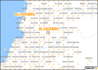
Al Khirbah (Mont-Liban, Lebanon)Al Khirbah is a town in the Mont-Liban region of Lebanon. An overview map of the region around Al Khirbah is displayed below.
regional and 3d topo map of Al Khirbah, Lebanon ::
Al Khirbah airports ::
The nearest airport is BEY - Beirut Rafic Hariri Intl, located 30.1 km south west of Al Khirbah.
Other airports nearby include DAM - Damascus Intl (97.5 km south east), RPN - Rosh Pina Mahanaim I Ben Yaakov (114.0 km south), HFA - Haifa (146.8 km south west), LTK - Latakia Bassel Al Assad Intl (156.7 km north), Nearby towns ::
Al ‘Aqabah (0.0km north) //
Al Qarqūf (0.0km north) //
Buq‘ātā (0.0km north) //
As Sahlah (0.0km north) //
Al Ḩişār (1.5km west) //
Ḩayy Mār Jirjis (1.9km south) //
Fayţrūn (1.9km south) //
Mār Ḑūmiţ (1.9km south) //
Aş Şala‘ah (1.9km north) //
Waţāʼ Ţabarīyah (1.9km north) //
An Nabbūţ (1.9km south) //
Al Ḩamāsīyāt (1.9km north) //
Aş Şawwānah (1.9km south) //
Ḩayy ar Ruʼays (2.4km north west) //
Wādī ‘Ayn al ‘Ullayq (2.4km south west) //
Ar Rāmiyah (2.4km north west) //
Al Wādī (2.4km north west) //
Aghbat al Fawqā (2.4km north west) //
Ra‘shīn (2.4km north west) //
Ḩayy al ‘Ayn (2.4km north west) //
Waţāʼ al Lawz (2.4km north east) //
Ḩayy as Sayyidah (2.4km north east) //
Ash Shāwī (2.4km south east) //
‘Ayn al Jurn (2.4km north east) //
Miḩqān al Maz̧lūm (2.4km north east) //
Al Mughaysil (2.4km north east) //
Al Balāţ (2.4km south east) //
Al Mabrak (2.4km south east) //
Najd (2.4km south east) //
[all distances 'as the bird flies' and approximate] 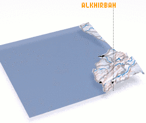 Places with similar names to Al Khirbah, Lebanon ::
// Al Khurayb (IQ)
// Al Khirbah (EG)
// Al Khirbah (TN)
// Al Khirbah (LB)
// Al Kharābah (SA)
// Al Khuraybah (SA)
// Al Kharābah (SD)
// Al Khuraybah (JO)
// Al Khuraybah (JO)
// Al Khirbah (LY)
Disclaimer :: Information on this page comes without warranty of any kind |
||
|
Where is Al Khirbah? Elevation and coordinates ::
Latitude (lat): 34°0'0"N Longitude (lon): 35°44'0"E
Elevation (approx.): 1245m (map arrows pan, magnifying glasses zoom) |
||
|
Visiting Al Khirbah? Hotel/Accommodation ::
Book a hotel in Al Khirbah Travel Guide ::
Buy a travel guide for Lebanon rental cars ::
car rental offers GPS waypoint ::
download a GPX waypoint (PoI) of Al Khirbah for your GPS receiver
|
||