|
search place name
|
||
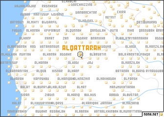
Al Qaţţārah (Mont-Liban, Lebanon)Al Qaţţārah is a town in the Mont-Liban region of Lebanon. An overview map of the region around Al Qaţţārah is displayed below.
regional and 3d topo map of Al Qaţţārah, Lebanon ::
Al Qaţţārah airports ::
The nearest airport is BEY - Beirut Rafic Hariri Intl, located 48.6 km south west of Al Qaţţārah.
Other airports nearby include DAM - Damascus Intl (109.2 km south east), RPN - Rosh Pina Mahanaim I Ben Yaakov (134.8 km south), LTK - Latakia Bassel Al Assad Intl (135.9 km north), HFA - Haifa (167.2 km south west), Nearby towns ::
Ghammās al Qaţţārah (0.0km north) //
Al ‘Aşbah (0.0km north) //
Mayfūq (0.0km north) //
Kafr Shillah (0.0km north) //
Ḩārat ash Shamīs (0.0km north) //
Al Marjah (1.9km south) //
Liḩfid (1.9km south) //
Al Waţāʼ (1.5km west) //
Ash Shumaysāt (1.9km south) //
Mazra‘at Mār Ilyās (1.9km south) //
Dayr al Qaţţārah (1.5km east) //
Şulayyib Rām (1.5km east) //
Rām (1.5km east) //
Al ‘Arabah (1.9km north) //
Rāshā (1.9km north) //
Ḩayy as Sayyidah (2.4km south west) //
Al Wādī (2.4km south west) //
Ḩayy Mār Isţifān (2.4km south west) //
Saqy Rishmayyā (2.4km south east) //
Jāj (2.4km south east) //
Al Ansīl (2.4km south east) //
Al Wādī (2.4km north west) //
Miḩmarsh (2.4km north west) //
Al ‘Alālī (2.4km north west) //
Ḩayy Bayt ash Shanā‘irī (2.4km north west) //
Ḩayy Bayt ‘Aţīyah (2.4km north west) //
Ḩadtūn (2.4km north east) //
Al Khāribah (3.1km west) //
Az Zakrūr (3.7km south) //
[all distances 'as the bird flies' and approximate]  Places with similar names to Al Qaţţārah, Lebanon ::
// Al Qaţţārah (IQ)
// Alcaidaria (PT)
// Alcaidaria (PT)
// Alcudra (PT)
// Algodor (PT)
// Al Quţūrī (EG)
// Alcútar (ES)
// Alkadar (RU)
// Alek Dārī (IR)
// Al Akhḑar (SA)
Disclaimer :: Information on this page comes without warranty of any kind |
||
|
Where is Al Qaţţārah? Elevation and coordinates ::
Latitude (lat): 34°11'0"N Longitude (lon): 35°47'0"E
Elevation (approx.): 954m (map arrows pan, magnifying glasses zoom) |
||
|
Visiting Al Qaţţārah? Hotel/Accommodation ::
Book a hotel in Al Qaţţārah Travel Guide ::
Buy a travel guide for Lebanon rental cars ::
car rental offers GPS waypoint ::
download a GPX waypoint (PoI) of Al Qaţţārah for your GPS receiver
|
||