|
search place name
|
||
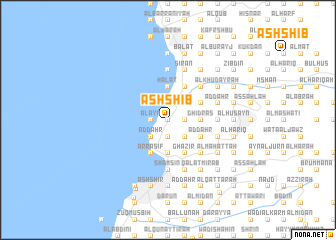
Ash Shi‘b (Mont-Liban, Lebanon)Ash Shi‘b is a town in the Mont-Liban region of Lebanon. An overview map of the region around Ash Shi‘b is displayed below.
regional and 3d topo map of Ash Shi‘b, Lebanon ::
Ash Shi‘b airports ::
The nearest airport is BEY - Beirut Rafic Hariri Intl, located 29.5 km south west of Ash Shi‘b.
Other airports nearby include DAM - Damascus Intl (107.0 km south east), RPN - Rosh Pina Mahanaim I Ben Yaakov (118.8 km south), HFA - Haifa (148.7 km south), LTK - Latakia Bassel Al Assad Intl (152.4 km north), Nearby towns ::
Bqāq ad Dīn (0.0km north) //
Ḩayy al Qiddīsah Ḩannah (0.0km north) //
Kafr Shaḩḩām (0.0km north) //
Al Khirbah (0.0km north) //
Al Manzilah (1.9km south) //
Qūwālah (1.9km north) //
Jisr Nahr Ibrāhīm (1.9km north) //
Shqīq at Taḩtā (1.9km north) //
Ḩayy al Muqayţīyah (1.9km north) //
Nahr Ibrāhīm (1.9km north) //
Kafr Jrīf (1.5km east) //
Shqīq (1.9km north) //
As Sarjī (1.5km east) //
Al Qmayzrī (1.5km west) //
Ḩayy Mār Ya‘qūb (1.5km west) //
Ḩayy Mār Yūḩannā (1.5km west) //
Al ‘Ayn (1.5km west) //
Al Bwār (1.5km west) //
Aş Şār (1.9km north) //
An Nammūrah (1.5km east) //
Ḑahr Badrīs (1.5km east) //
Fatqā (2.4km south east) //
‘Ayn aş Şughayrah (2.4km south west) //
Aş Şafrāʼ (2.4km south west) //
Ḩayy Mār Şūfiyā (2.4km south west) //
Ad Daqārīn (2.4km south west) //
Admā ad Dafnah (2.4km south west) //
Al Bayādir (2.4km south east) //
Ḩayy Ḑahr al Balāţah (2.4km south east) //
[all distances 'as the bird flies' and approximate]  Places with similar names to Ash Shi‘b, Lebanon ::
// Ash Shaghab (EG)
// Ash Shaghabah (EG)
// Ash Shaybī (SA)
// Ash Shāb (OM)
// Ashcheb (RU)
// Ash Sha‘b (KW)
// Ash Shu‘aybah (KW)
// Ash Shahbāʼ (SY)
// Ash Shu‘ayb (SY)
// Ash Shu‘aybah (IQ)
Disclaimer :: Information on this page comes without warranty of any kind |
||
|
Where is Ash Shi‘b? Elevation and coordinates ::
Latitude (lat): 34°3'0"N Longitude (lon): 35°39'0"E
Elevation (approx.): 164m (map arrows pan, magnifying glasses zoom) |
||
|
Visiting Ash Shi‘b? Hotel/Accommodation ::
Book a hotel in Ash Shi‘b Travel Guide ::
Buy a travel guide for Lebanon rental cars ::
car rental offers GPS waypoint ::
download a GPX waypoint (PoI) of Ash Shi‘b for your GPS receiver
|
||