|
search place name
|
||
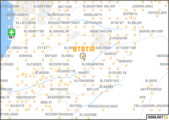
Btātir (Mont-Liban, Lebanon)Btātir is a town in the Mont-Liban region of Lebanon. An overview map of the region around Btātir is displayed below.
regional and 3d topo map of Btātir, Lebanon ::
Btātir airports ::
The nearest airport is BEY - Beirut Rafic Hariri Intl, located 14.7 km north west of Btātir.
Other airports nearby include RPN - Rosh Pina Mahanaim I Ben Yaakov (87.3 km south), DAM - Damascus Intl (90.8 km south east), HFA - Haifa (119.6 km south west), OMF - Mafraq King Hussein (167.0 km south), Nearby towns ::
‘Ayn al Ḩalazūn (0.0km north) //
Bsirrīn (0.0km north) //
Bţallūn (1.9km north) //
Shaqīf Bţallūn (1.9km north) //
Ḩabrammūn (1.9km south) //
Ma‘şrītī (1.9km south) //
Kafr Ḩayy (1.9km south) //
Mazra‘at an Nahr (1.9km south) //
Ar Rujmah (2.4km north west) //
Al Manşūrīyah (2.4km north west) //
‘Ayn al Marj (2.4km north west) //
‘Ayn al Furaydīs (2.4km north west) //
Qassānīyah (2.4km north west) //
Shānayh (2.4km north east) //
Ḩārat Ḩamzah (2.4km south east) //
Ar Ramlīyah (2.4km south east) //
Al Mashrafah (2.4km south east) //
Al Marj (3.1km west) //
Kafr ‘Ammay (3.1km west) //
‘Ayn al Jadīdah (3.7km north) //
Shūrīt (3.7km south) //
Kafr Nīs (3.7km south) //
Bḩamdūn (3.6km north east) //
Bkhishtay (4.0km north west) //
Bḩūwārah (3.6km north west) //
Al Ghābūn (3.6km north west) //
Al Manţarah (4.0km north east) //
Ruʼaysat an Nu‘mān (3.6km south west) //
Majdal al M‘ūsh (4.0km south west) //
[all distances 'as the bird flies' and approximate]  Places with similar names to Btātir, Lebanon ::
// Boada de Roa (ES)
// Boudiédara (BF)
// Bédaïdoura (TD)
// Botadero (CO)
// Botadero (EC)
// Budadiri (UG)
// Bedo Dāhri (PK)
// Bet Uttara (PK)
// Bet Uttera (PK)
// Bode Dāhri (PK)
Disclaimer :: Information on this page comes without warranty of any kind |
||
|
Where is Btātir? Elevation and coordinates ::
Latitude (lat): 33°46'0"N Longitude (lon): 35°38'0"E
Elevation (approx.): 987m (map arrows pan, magnifying glasses zoom) |
||
|
Visiting Btātir? Hotel/Accommodation ::
Book a hotel in Btātir Travel Guide ::
Buy a travel guide for Lebanon rental cars ::
car rental offers GPS waypoint ::
download a GPX waypoint (PoI) of Btātir for your GPS receiver
|
||