|
search place name
|
||
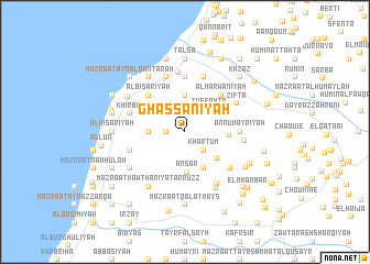
Ghassānīyah (Lebanon)Ghassānīyah is a town in Lebanon. An overview map of the region around Ghassānīyah is displayed below.
regional and 3d topo map of Ghassānīyah, Lebanon ::
Ghassānīyah airports ::
The nearest airport is BEY - Beirut Rafic Hariri Intl, located 46.6 km north of Ghassānīyah.
Other airports nearby include RPN - Rosh Pina Mahanaim I Ben Yaakov (52.6 km south east), HFA - Haifa (73.2 km south west), DAM - Damascus Intl (108.3 km east), OMF - Mafraq King Hussein (145.1 km south east), Nearby towns ::
Qa‘qa‘īyat aş Şanawbar (1.9km north) //
Al Bāblīyah (1.5km west) //
Mazra‘at al Qurayyah (1.5km west) //
Kharţūm (2.4km south east) //
Tuffāḩtā (3.1km north east) //
Ar Rawāʼis (3.1km west) //
Mazra‘at Tibnā (3.7km north) //
Mi‘marīyat al Kharāb (3.7km north) //
Anşār (4.1km south) //
Khirbat ad Duwayr (3.6km north west) //
Mazra‘at Sīnayy (4.0km south east) //
Mazraat Bsaffoûr (3.8km south east) //
Kaoutarîet es Siyâd (3.8km east) //
Al Marwānīyah (4.8km north east) //
Al Bīsārīyah (4.8km north west) //
Mazra‘at as Saknūnīyah (5.6km north) //
An Numayrīyah (4.6km east) //
An Najjārīyah (5.6km north) //
Mazra‘at ad Dāwūdīyah (5.0km west) //
Ash Shamsīyah (5.8km north) //
Mazra‘at al Wusayţá (5.8km north) //
Mazra‘at as Snaybir (5.8km north) //
Mazra‘at ad Dāwūdīyah (5.8km north) //
Mazra‘at Dayr Taqlā (5.0km west) //
Mazraat Châl Baal (5.4km south east) //
Ziftā (5.3km north east) //
El Qattinîyé (5.1km east) //
Al ‘Addūsīyah (6.1km north) //
Mazraat Dmoûl (5.9km south east) //
[all distances 'as the bird flies' and approximate] 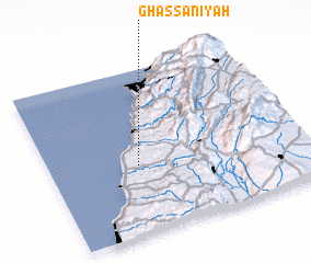 Places with similar names to Ghassānīyah, Lebanon ::
Disclaimer :: Information on this page comes without warranty of any kind |
||
|
Where is Ghassānīyah? Elevation and coordinates ::
Latitude (lat): 33°25'0"N Longitude (lon): 35°21'0"E
Elevation (approx.): 235m (map arrows pan, magnifying glasses zoom) |
||
|
Visiting Ghassānīyah? Hotel/Accommodation ::
Book a hotel in Ghassānīyah Travel Guide ::
Buy a travel guide for Lebanon rental cars ::
car rental offers GPS waypoint ::
download a GPX waypoint (PoI) of Ghassānīyah for your GPS receiver
|
||