|
search place name
|
||
Qamar ed Dîne (Béqaa, Lebanon)Qamar ed Dîne is a town in the Béqaa region of Lebanon. An overview map of the region around Qamar ed Dîne is displayed below.
regional and 3d topo map of Qamar ed Dîne, Lebanon ::

Qamar ed Dîne airports ::
The nearest airport is BEY - Beirut Rafic Hariri Intl, located 38.6 km west of Qamar ed Dîne.
Other airports nearby include DAM - Damascus Intl (75.3 km south east), RPN - Rosh Pina Mahanaim I Ben Yaakov (101.9 km south), HFA - Haifa (141.1 km south west), OMF - Mafraq King Hussein (169.7 km south), Nearby towns ::
Berbâra (0.5km south west) //
Zahlé (0.8km south) //
El Midâne (0.8km south) //
El Harqât (0.9km north east) //
Ouâdi el Aarâyech (0.8km north west) //
El Hemmâr (1.3km north west) //
Haouch ez Zaraané (1.3km south east) //
Rassîyé (1.5km south west) //
Mâr Eliâs (1.7km south west) //
Haouch el Omara (2.3km south) //
Maallaqa (2.3km south east) //
El Karak (2.3km east) //
Al Qāţi‘ (3.4km west) //
Qummul (3.4km west) //
Al Ḩārah (3.4km west) //
Al Wādī (3.4km west) //
Qaa er Rîm (3.8km north west) //
Ḩazzirtā (4.4km north west) //
Sa‘d Nāyil (4.8km south west) //
El Fourzol (4.9km north east) //
At Tuwaytah (5.0km west) //
Ta‘labāyā (5.6km south west) //
Ḩayy al Jāmi‘ (5.6km south west) //
Az Zu‘rūrah (5.6km south west) //
Ḩayy Mār Ilyās (5.6km south west) //
Ḩaql al ‘Ayn (5.6km south west) //
Ḩayy ad Duhaynī (5.6km south west) //
Jalālā (5.6km south west) //
Ḩayy al Ba‘l (5.6km south west) //
[all distances 'as the bird flies' and approximate] 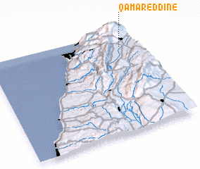 Places with similar names to Qamar ed Dîne, Lebanon ::
// Kamardan (RU)
// Kamardina (RU)
// Komardina (RU)
// Kumordino (RU)
// Camroden (US)
// Kimberton (US)
// Comertown (US)
// Kambaridéni (BF)
// Kamar Dehnow (IR)
// Kamar Dūnī (IR)
Disclaimer :: Information on this page comes without warranty of any kind |
||
|
Where is Qamar ed Dîne? Elevation and coordinates ::
Latitude (lat): 33°51'25"N Longitude (lon): 35°54'10"E
Elevation (approx.): 1164m (map arrows pan, magnifying glasses zoom) |
||
|
Visiting Qamar ed Dîne? Hotel/Accommodation ::
Book a hotel in Qamar ed Dîne Travel Guide ::
Buy a travel guide for Lebanon rental cars ::
car rental offers GPS waypoint ::
download a GPX waypoint (PoI) of Qamar ed Dîne for your GPS receiver
|
||