|
search place name
|
||
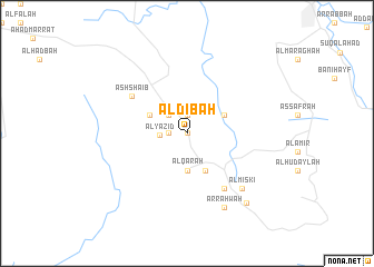
Āl Dibah (Saudi Arabia)Āl Dibah is a town in Saudi Arabia. An overview map of the region around Āl Dibah is displayed below.
regional and 3d topo map of Āl Dibah, Saudi Arabia ::
Āl Dibah airports ::
The nearest airport is AHB - Abha, located 16.2 km north of Āl Dibah.
Other airports nearby include GIZ - Gizan King Abdullah Bin Abdulaziz (133.2 km south), EAM - Nejran (190.1 km east), BHH - Bisha (208.7 km north), Nearby towns ::
Āl ad Duwayḩ (0.0km north) //
Āl Sirḩān (1.9km north) //
Al Qadhf (1.8km west) //
Al Mushazzib (2.6km north west) //
Āl Dawdaf (2.6km north west) //
Al Yazīd (2.6km west) //
Al Maḩshūsh (3.7km south) //
Al Qar‘ah (3.7km south) //
Al Majma (4.0km north east) //
Al Qarawayn (4.1km south east) //
Al Qalt (4.1km south east) //
Al Farwan (4.0km north west) //
Al Junibah (6.6km south east) //
Ad Dhid (6.6km south east) //
Al ‘Az̧āz̧ah (6.5km north west) //
Ash Shāʼib (6.5km north west) //
Al Miskī (7.7km south east) //
Ar Rahwah (8.2km south east) //
Sūq al Ithnayn (9.0km south east) //
[all distances 'as the bird flies' and approximate]  Places with similar names to Āl Dibah, Saudi Arabia ::
// Aldabó (CU)
// Ahlatoba (TR)
// Alitub (RU)
// Aldeia Baia (MZ)
// Aldaba (ES)
// Al ‘Adhbah (QA)
// Aldaba (ES)
// Aldeby (GB)
// Aultbea (GB)
// Aldāba (IN)
Disclaimer :: Information on this page comes without warranty of any kind |
||
|
Where is Āl Dibah? Elevation and coordinates ::
Latitude (lat): 18°6'0"N Longitude (lon): 42°42'0"E
Elevation (approx.): 2194m (map arrows pan, magnifying glasses zoom) |
||
|
Visiting Āl Dibah? Hotel/Accommodation ::
Book a hotel in Āl Dibah Travel Guide ::
rental cars ::
car rental offers GPS waypoint ::
download a GPX waypoint (PoI) of Āl Dibah for your GPS receiver
|
||