|
search place name
|
||
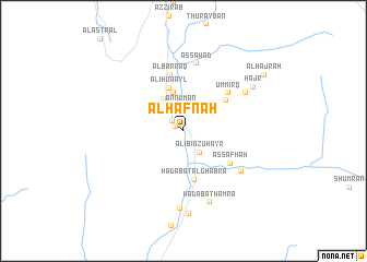
Al Ḩafnah (Saudi Arabia)Al Ḩafnah is a town in Saudi Arabia. An overview map of the region around Al Ḩafnah is displayed below.
regional and 3d topo map of Al Ḩafnah, Saudi Arabia ::
Al Ḩafnah airports ::
The nearest airport is ABT - El-baha Al Baha, located 106.5 km north of Al Ḩafnah.
Other airports nearby include BHH - Bisha (110.4 km north east), AHB - Abha (151.8 km south east), Nearby towns ::
Kudayd (0.9km north west) //
Al Ghabrāʼ (1.5km north west) //
Athfālah (2.2km north west) //
Al Ḩamadah (2.2km north west) //
An Nu‘mān (2.5km north) //
Asfalah (2.7km north) //
‘Ali Bin Zuhayr (2.7km south east) //
Al Karbah (3.8km north west) //
Qirbish (4.0km north) //
‘Ali Ḩuwayl (4.6km north) //
Ḩadabat al Ghabrāʼ (5.1km south) //
Sāḩil (5.2km north east) //
Aş Şafḩah (5.6km south east) //
Al Barraq (5.9km north) //
Umm ‘Irq (5.8km north east) //
As Sawād (7.0km north) //
As Sarbah (6.9km south east) //
Surrah (7.2km north east) //
Ḩadabat Ḩamrāʼ (7.7km south) //
Sūq ath Thulāthāʼ (7.9km south) //
Ḩajr (8.1km north east) //
Qarn Hadhīl (8.5km south) //
Al Ḩajrah (9.7km north east) //
[all distances 'as the bird flies' and approximate] 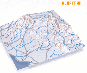
Disclaimer :: Information on this page comes without warranty of any kind |
||
|
Where is Al Ḩafnah? Elevation and coordinates ::
Latitude (lat): 19°20'55"N Longitude (lon): 41°48'33"E
Elevation (approx.): 486m (map arrows pan, magnifying glasses zoom) |
||
|
Visiting Al Ḩafnah? Hotel/Accommodation ::
Book a hotel in Al Ḩafnah Travel Guide ::
rental cars ::
car rental offers GPS waypoint ::
download a GPX waypoint (PoI) of Al Ḩafnah for your GPS receiver
|
||