|
search place name
|
||
Kampong Bagan Upeh (Melaka, Malaysia)Kampong Bagan Upeh is a town in the Melaka region of Malaysia. An overview map of the region around Kampong Bagan Upeh is displayed below.
regional and 3d topo map of Kampong Bagan Upeh, Malaysia ::

Kampong Bagan Upeh airports ::
The nearest airport is MKZ - Malacca, located 30.5 km north west of Kampong Bagan Upeh.
Other airports nearby include KUL - Kuala Lumpur Intl (110.6 km north west), DUM - Dumai Pinang Kampai (129.6 km south west), JHB - Johor Bahru Sultan Ismail (142.1 km east), XSP - Singapore Seletar (172.4 km south east), Nearby towns ::
Kampong Pengkalan Leban (0.0km north) //
Kampong Permatang Tulang (0.0km north) //
Kampong Alai (1.9km west) //
Kampong Sebatu Bukit (1.9km west) //
Kampong Pinang (1.9km east) //
Kesang (1.9km east) //
Kampong Sungai Rambai (1.9km east) //
Kampong Parit Penghulu (2.6km north east) //
Kampong Parit Putat (3.7km north) //
Pasir (3.7km north) //
Kampong Bukit Gadong (3.7km north) //
Kampong Terus (3.7km east) //
Kampong Parit Besar (4.1km north west) //
Kampong Sungai Ayer Tawar (4.1km north west) //
Kampong Parit Derhaka (4.1km north west) //
Kampong Ayer Tawar (4.1km north west) //
Kampong Parit Melintang (4.1km north west) //
Kampong Pasir (4.1km north west) //
Kampong Parit Sidang Seman (4.1km north east) //
Kampong Parit Perawas (4.1km north east) //
Telok Batu Gajah (5.2km north west) //
Kampong Batu Gajah (5.2km north west) //
Kampong Parit Gantong (5.2km north east) //
Kampong Tengah Padang (5.9km west) //
Kampong Tasek (5.9km east) //
Kampong Tanjong Gading (5.9km east) //
Kampong Telok (6.7km north west) //
Kampong Telok Gong (6.7km north east) //
Merlimau (6.7km north west) //
[all distances 'as the bird flies' and approximate] 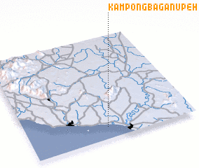 Places with similar names to Kampong Bagan Upeh, Malaysia :: Disclaimer :: Information on this page comes without warranty of any kind |
||
|
Where is Kampong Bagan Upeh? Elevation and coordinates ::
Latitude (lat): 2°7'0"N Longitude (lon): 102°29'0"E
Elevation (approx.): 9m (map arrows pan, magnifying glasses zoom) |
||
|
Visiting Kampong Bagan Upeh? Hotel/Accommodation ::
Book a hotel in Kampong Bagan Upeh Travel Guide ::
Buy a travel guide for Malaysia rental cars ::
car rental offers GPS waypoint ::
download a GPX waypoint (PoI) of Kampong Bagan Upeh for your GPS receiver
|
||