|
search place name
|
||
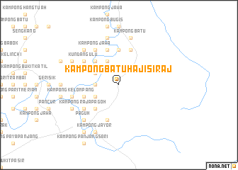
Kampong Batu Haji Siraj (Johor, Malaysia)Kampong Batu Haji Siraj is a town in the Johor region of Malaysia. An overview map of the region around Kampong Batu Haji Siraj is displayed below.
regional and 3d topo map of Kampong Batu Haji Siraj, Malaysia ::
Kampong Batu Haji Siraj airports ::
The nearest airport is MKZ - Malacca, located 63.3 km west of Kampong Batu Haji Siraj.
Other airports nearby include JHB - Johor Bahru Sultan Ismail (113.2 km south east), KUL - Kuala Lumpur Intl (137.1 km north west), XSP - Singapore Seletar (145.5 km south east), QPG - Paya Lebar (153.0 km south east), Nearby towns ::
Kampong Renchong (3.7km west) //
Kampong Paya Geronggang (4.1km north west) //
Kampong Telok Bugak (4.1km north west) //
Kampong Paya Lempah (4.1km south west) //
Kampong Liang Batu (5.2km north west) //
Kampong Paya Redan (5.2km south west) //
Kampong Gombang (5.6km north) //
Kampong Sentosa (5.9km north) //
Kampong Baharu Melayu (5.9km north) //
Kampong Gelam (5.9km west) //
Kampong Telok Penchu (5.9km north) //
Kampong Penchu (5.9km north) //
Kampong Sebasu (5.9km south) //
Kundang Ulu (6.7km north west) //
Kampong Raja Pagoh (6.7km south west) //
Kampong Jawa (6.7km north west) //
Kampong Batu (7.6km north) //
Kampong Saujana (7.6km north) //
Kampong Olak Sepam (7.6km west) //
Kampong Kelompang (7.6km west) //
Kampong Sungai Berani (7.6km north) //
Kampong Parit Tepi (7.9km north west) //
Kampong Selanchar (7.9km south west) //
Paguh (7.9km south west) //
Kampong Parit Medan (8.3km north west) //
Kampong Tanggol Aur (8.3km south west) //
Kampong Jayor (8.3km south west) //
Kampong Sari Baharu (9.3km south west) //
[all distances 'as the bird flies' and approximate]  Places with similar names to Kampong Batu Haji Siraj, Malaysia :: Disclaimer :: Information on this page comes without warranty of any kind |
||
|
Where is Kampong Batu Haji Siraj? Elevation and coordinates ::
Latitude (lat): 2°12'0"N Longitude (lon): 102°49'0"E
Elevation (approx.): 11m (map arrows pan, magnifying glasses zoom) |
||
|
Visiting Kampong Batu Haji Siraj? Hotel/Accommodation ::
Book a hotel in Kampong Batu Haji Siraj Travel Guide ::
Buy a travel guide for Malaysia rental cars ::
car rental offers GPS waypoint ::
download a GPX waypoint (PoI) of Kampong Batu Haji Siraj for your GPS receiver
|
||