|
search place name
|
||
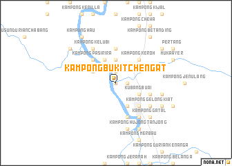
Kampong Bukit Chengat (Kelantan, Malaysia)Kampong Bukit Chengat is a town in the Kelantan region of Malaysia. An overview map of the region around Kampong Bukit Chengat is displayed below.
regional and 3d topo map of Kampong Bukit Chengat, Malaysia ::
Kampong Bukit Chengat airports ::
The nearest airport is KBR - Kota Bahru Sultan Ismail Petra, located 66.0 km north of Kampong Bukit Chengat.
Other airports nearby include TGG - Kuala Terengganu Sultan Mahmud (106.1 km east), NAW - Narathiwat (113.7 km north west), IPH - Ipoh Sultan Azlan Shah (163.7 km south west), PAN - Pattani (173.9 km north west), Nearby towns ::
Kampong Lubok Kawah (0.0km north) //
Kampong Batu Jong (1.8km east) //
Sungai Nal (1.8km east) //
Kampong Sungai Nal (1.9km north) //
Kampong Limau Manis (1.9km north) //
Kampong Bedal Besar (3.7km north) //
Kampong Batu Mengkebang (4.1km south east) //
Kampong Aur Duri (4.1km south east) //
Kubang Buai (4.1km south east) //
Kampong Baharu Pasir Kelang (4.1km north west) //
Kampong Pasir Kelang (4.1km north west) //
Kampong Lepan Pauh (4.1km north west) //
Kampung Banggul Gucil (5.2km south east) //
Kampong Keroh (5.2km north east) //
Kampong Pasir Ira (5.2km north west) //
Kampong Bedal (5.6km north) //
Kampong Jelutong (5.6km north) //
Kampong Sungai Bedal (5.6km north) //
Kampong Bedal Lama (5.6km north) //
Kampong Batu Lada (5.9km south) //
Kampong Sedik (5.8km east) //
Kuala Kerai (6.7km south east) //
Kampong Gelong Kiat (6.7km south east) //
Kampong Tengah (6.7km south east) //
Kampong Kelubi (6.7km north west) //
Kampung Pasir Lalat (7.6km south) //
Kampong Payong (7.6km east) //
Kampong Gatal (7.8km south east) //
Kampong Hujong Tanjong (8.3km south east) //
[all distances 'as the bird flies' and approximate]  Places with similar names to Kampong Bukit Chengat, Malaysia ::
// Kampong Bukit Changgang (MY)
// Kampong Bukit Changkol (MY)
Disclaimer :: Information on this page comes without warranty of any kind |
||
|
Where is Kampong Bukit Chengat? Elevation and coordinates ::
Latitude (lat): 5°35'0"N Longitude (lon): 102°10'0"E
Elevation (approx.): 47m (map arrows pan, magnifying glasses zoom) |
||
|
Visiting Kampong Bukit Chengat? Hotel/Accommodation ::
Book a hotel in Kampong Bukit Chengat Travel Guide ::
Buy a travel guide for Malaysia rental cars ::
car rental offers GPS waypoint ::
download a GPX waypoint (PoI) of Kampong Bukit Chengat for your GPS receiver
|
||